Category Archives: NPOTA

POTA/WWFF/U.S. Islands: Rock Island State Park, WI

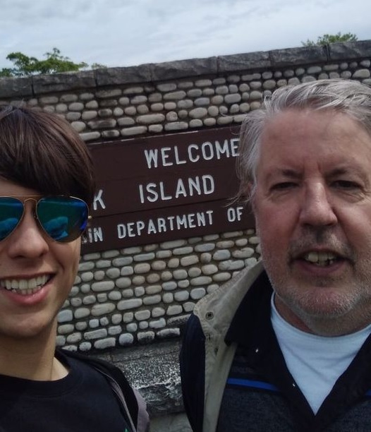
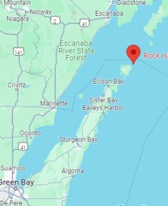
RockIslandRockIslandMapOver the Fourth of July weekend, my son and I decided to make a spur-of-the-moment camping trip to Rock Island State Park, Wisconsin, which is at the northern tip of Door County and at the entrance of Green Bay. It’s a state park accessible only by boat. Unless you have your own boat, you take a car ferry from the mainland to Washington Island, drive across that Island, park your car, and then take a passenger ferry to Rock Island.  No reservations are required for either ferry, and they add as many boats as necessary to accommodate the traffic.  We bought a round trip on both ferries at the dock, and the cost was about $90 for one car and two passengers.
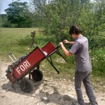
cartThe campground is about a quarter mile from the boat landing, and the park provides carts, shown here, to move your stuff. My son did the hauling, and we quickly had our campsite, which was right on the shore of Lake Michigan, set up.

Like most state park campgrounds, sites fill up fast, especially on a holiday weekend. But when I checked two days before arrival, there were sites available for both Friday and Saturday night. They were different sites, meaning we would have to move after the first night. But fortunately, the occupants of one of the sites had left early, and after checking with the campground host and warden, we were allowed to have the same site both nights.

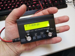
Of course, it wouldn’t be a camping trip without bringing a radio, and I brought along the QRP Labs QCX Mini, shown here. This is a handheld CW transceiver for one band (in my case, 40 meters). For the power supply, I brought along my fish finder battery, which I also used to charge my cell phone. (We did have good cell phone service from most of the island, including the campground, through Boost Mobile.  My son, on the other hand, who has service through Tello, had no signal, so your mileage might vary.)

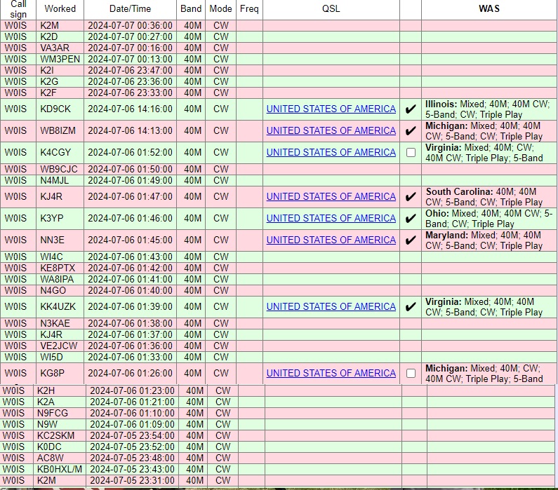
I made a total of 33 radio contacts over the course of a couple of hours, covering the eastern half of North America, from Quebec to Georgia.  If I had stayed up later, I would have been able to work the western United States.  But 40 meters covers long distances best at night, and I shut down around local sunset, meaning the West Coast didn’t have a chance to work me.  Ideally, I would have been on 20 meters as well for some daytime contacts, but I wanted to keep the station size and weight to a minimum.  The complete log is shown below.
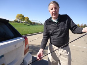
GolfBallRetrieverI used my usual antenna, namely, a dipole supported by my trusty golf ball retriever leaning against the picnic table, with the two 33-foot wires extending out from the table.  The wires were actually just draped over tree branches.  You don’t need an elaborate antenna to get out well.  Despite the various reasons that it shouldn’t work (too low, touching trees, etc.), it got out very well.

You will notice that many of the contacts are with 1×1 call signs who, along with WM3PEN, were taking part in the 13 Colonies special event.  If you are doing a park activation during a similar event or contest, that’s always a good opportunity to put some contacts in the log.

Our campsite

Our campsite

Other notable contacts included WB8IZM, who was operating from another park, Potagannissing Flooding Wildlife Management Area near Sault Ste. Marie, Michigan, and KB0HXL, who was operating from his car in Indiana.

I’ve always enjoyed operating from remote locations with portable equipment, an activity which has gotten easier over the years with the advent of radios such as the QCX.  It’s also become a very popular activity.  Starting in 2016, the National Parks On The Air (NPOTA) activity was extremely popular, and after it ended, many American hams continued, thanks to the WWFF (World Wide Flora and Fauna in Amateur Radio) activity that had started to enjoy popularity in Europe.  Shortly thereafter, a separate program, Parks On The Air (POTA) has become extremely popular.  In addition, since I was on an Island, I was able to participate in the U.S. Islands Award Program.  I was able to hand out contacts for all three programs.  I didn’t make the required 44 contacts to make it an official activation for WWFF, but I was able to meet the minimums for both POTA and US Islands.  If I had been able to get on 20 meters, I’m sure I would have made many more contacts, but as it was, I was able to give credit for a fairly rare park.

And even though we had cell phone coverage (except for a brief outage on Sunday morning), it’s reassuring to know that, in case of emergency, we have a reliable method of communications with the outside world.

Rock Island boathouse (43110794831)Rock Island was originally developed as the vacation getaway of inventor Chester Thordarson, founder of the transformer company that bears his name.  He built the iconic boathouse shown here, which serves as the terminal for the passenger ferry.  The campground is located about a quarter mile away, with a more distant backpacking campground somewhat further away.  We also hiked to Pottawatomie Light , Wisconsin’s oldest lighthouse, dating to 1836.  The lighthouse is about 1.5 miles from the campground.

With carts available, setting up camp on foot was relatively easy.  Unlike backpacking, where you have to consider every ounce, the carts made the trip fairly easy.  It would have worked a bit better to bring a wagon from home, since we could have just packed it once before getting on the ferry.  Also, the provided carts were somewhat heavy, and a wagon probably would have been a bit easier to move.  Large wheels are important, because the paths on Rock Island are, well, rocky.  I was initially thinking of just packing things in a roll-on suitcase, but this would have been a bad choice, since the wheels would have just been too small.  We used an inexpensive tent and air mattress.  The ground is covered with roots and rocks, so some kind of pad is a must.

Flush toilets are available near the boathouse, and the campground has vault toilets.  Drinking water is available near the boathouse.  We realized on the way that we hadn’t brought a water container, so we just bought a one-gallon jug of water and filled it as needed.  Firewood is available on the island for $7 (cash only),  We used that for most of our cooking, although I did some of it on the emergency stove I previously reviewed.  I discovered that four fuel tablets were about enough to boil enough water for oatmeal and coffee.  We had only a very small cooler, so for the first night, we cooked some brats on the fire, but on the second day, we ate packaged food such as ramen noodles, to which you just add hot water.  Another convenient meal choice was a prepared meal such as Hormel Compleats.  These avoid any cleanup, since you can just put the sealed meal in a pot of hot water.  Packets of meat such as the pulled pork we previously reviewed are also easy to cook this way.

There is a very small camp store on Rock Island, but other than a few bags of chips and a few Clif bars, they don’t sell food or camping supplies.  It’s mostly souvenirs and apparel.  So you do need to plan ahead.  But as long as you do your minimal planning, Rock Island provides an opportunity to easily do some camping completely off the grid.

RockIslandLog

x


Some links on this site are affiliate links, meaning this site earns a small commission if you make a purchase after using the link.

Field Day 2023: Greenberg Island, Wm. O’Brien State Park, MN

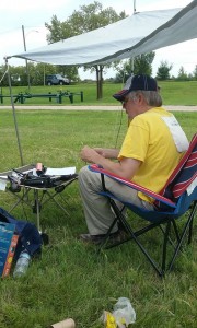
2023FDoperatingThis past weekend was ARRL Field Day, an operating event in which Amateur Radio operators set up in the field and see how many contacts they can make with portable equipment. It’s mostly a fun activity, but it also serves as a test of emergency capabilities. For many, this involves hauling large equipment, often powered by a gasoline generator, and setting up large antennas.  Often, large groups are involved in these operations.  It’s been around since 1933, so this year’s running marked the 90th anniversary.

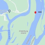
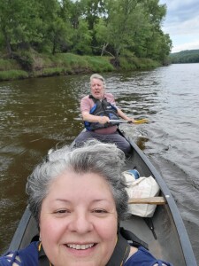
2023FDmapI prefer a simpler approach, and set out by myself or a smaller group with equipment that I can easily carry and quickly set up.  This year, instead of just driving to a park, I decided to operate from an island accessible only by boat.  In particular, I operated from Greenberg Island in the St. Croix River, part of William O’Brien State Park, Minnesota.  The plan was for my wife and I to do the operation, bringing our canoe from home.

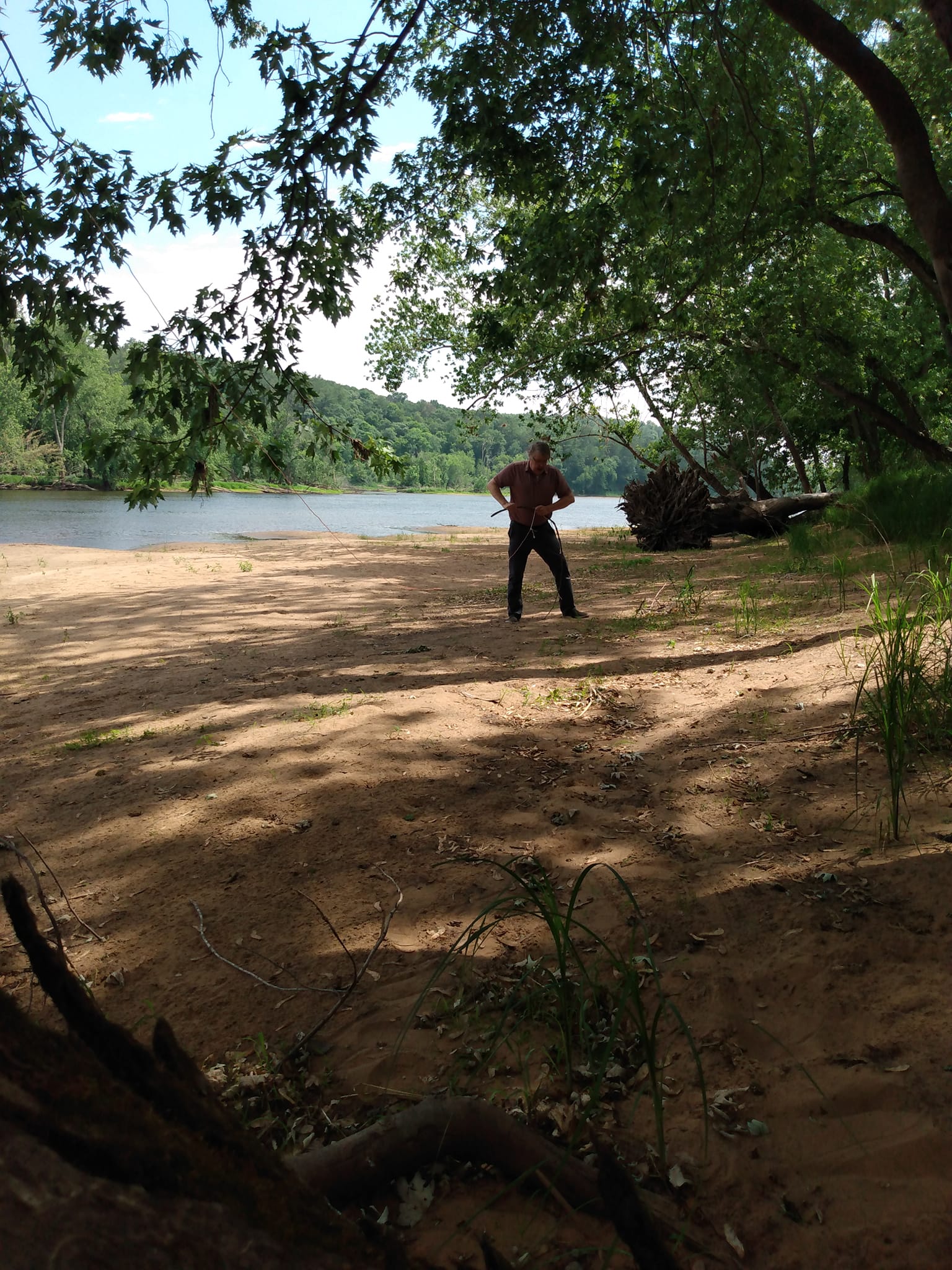
Setting up one end of my antenna. I'm breaking of a stick which I used as a stake to anchor it in the sand.

Setting up one end of my antenna. I’m breaking of a stick which I used as a stake to anchor it in the sand.

The initial weather reports didn’t look promising, so we decided not to take the canoe, and instead just operate from the mainland. But while driving there, the weather looked fine, so we decided to rent a canoe and activate the island as originally planned.

The island has been part of the park since 1958.  When I was a kid, there was a pedestrian bridge linking it to the mainland, with a trail covering part of the island.  Exploring the island was always a fun part of a trip to the park.  The bridge is long gone, and the only way to access it is by boat.  I did check first, and it’s perfectly legal to land there, although it is posted “No Camping.”  And not having been there for about 50 years, it was fun to explore the island again, but there was no trace of the old trails.

There were a few human footprints on the beach, but not many.  At the beach where we landed, there were deer footprints, as well as either a dog or a wolf.  The only other sign of humans was a fairly recent mylar balloon reading “happy birthday” which had landed in the brush just off the beach.  I inspected it carefully to see if it carried a note.  Unfortunately it didn’t, so I just picked it up and took it to a trash can on the mainland.

I was on the air from about 3:30 – 5:00 PM, and the weather held up fine. It started looking like rain and we headed back. We had a few drops of rain, but it didn’t start pouring until we had just left the park on the way home.

We found a beach on the east side of the island, and set up there. I used the QCX Mini, running 5 watts on 40 meter CW, and worked about 20 contacts.  The antenna was an inverted vee supported my trusty golf ball retriever shoved into the sand and leaning against a tree.  The power source was a fish finder battery.  I did purchase it new for Field Day, since the previous one was showing signs of wear after 7 years of abuse.

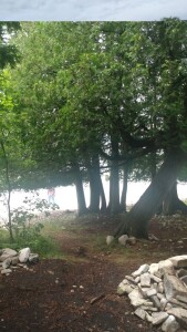
I forgot to bring a folding chair (although my wife remembered hers and was able to relax while I operated).  The fallen tree shown above served as a suitable substitute.

Heading home. KC0OIA at the bow, W0IS at the stern.

Heading home. KC0OIA at the bow, W0IS at the stern.

Best DX was Alabama, I believe. In addition to working Field Day, I submitted the logs for Parks On The Air (POTA), WWFF-KFF, and U.S. Islands Awards Program. This is the first time the island has been activated, and since we went over the magic number of 15 QSOs, it will count as being “qualified” for that program.

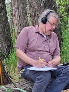
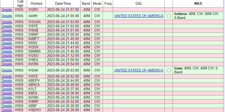
Thanks to the stations shown below, some at home, and some out in the field, for pulling in my 5 watt signal.  If you look carefully, you’ll see three dupes.  All of my logging is pencil and notebook, so sometimes it’s hard to remember who I just worked.

Will I ever save the world with my communications abilities?  Probably not.  But it’s good to know that with equipment I can carry with me, just a few minutes setting up, and a battery found in any car, I could get messages out to my friends and relatives in case of disaster, and could do the same thing for my neighbors.

Log2023FD


Some links are affiliate links, meaning that this site earns a small commission if you make a purchase after using the link.
Winter Field Day 2021

WFD1This previous weekend was Winter Field Day.  While this event is billed as an emergency preparedness exercise, it’s also simply a fun opportunity to get on the air from a portable location, and make the most of limited resources.

As happened with ARRL Field Day this past June, the event was affected by COVID-19.  Since the pandemic generally prevents operation as a group, many who would have otherwise participated stayed home.  But in my opinion, being part of a group is not what defines this event.  The event is not called “Group Day,” it is called “Field Day.”  The focus is operating from out in the field somewhere.  And while groups of people can be dangerous because of COVID, there is absolutely nothing that is unsafe about a field.  I was completely socially distanced during the entire event.  I saw a few other campers and said hello to some of them from 50 feet away.  As I’ve previously written, camping is an excellent safe way to travel during the pandemic.

As an emergency preparedness exercise, it seems to me that it was best to adapt to the actual emergency conditions.  Because of COVID, it wasn’t possible to do it as a group.  But in many emergency situations, a group of helpers might not be available to set up a station and get it on the air.  It seems to me that the ability to get a station on the air, even a minimalist station, without outside assistance, is a valuable skill in an emergency.

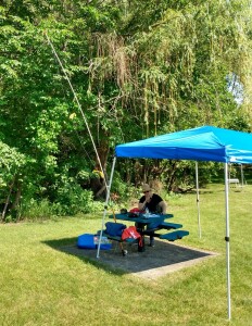
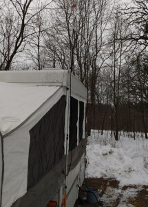
FD1For summer Field Day, my wife and I operated for an hour or two from a city park, shown here.  If it weren’t for all of the naysayers lamenting that they had to stay home for Winter Field Day, I probably would have done something similar and just operated for a while from the back yard, or maybe again from a city park.  But since so many people were lamenting that it was impossible to truly go out and operate away from home, I decided to do a winter camping trip in our popup camper.

I made reservations for William O’Brien State Park, which is only a 45 minute drive from home.  The temperature never got below 20 degrees, and it was actually a very nice weekend for camping.  There were several other campers in the campground.  I spotted three RV’s, as well as three family groups camping in tents.  Also, I believe at least one of the park’s cabins was occupied.  So at least a few non-hams were undaunted by being in the field in the middle of winter, in the middle of a pandemic.

Even though it’s not insulated, the popup camper stays quite warm inside with electric heaters and/or the furnace running.  Since I was paying for the electricity anyway, I used two electric space heaters.  One was plugged into the outlet in the camper, which was hooked up to the campground’s 30 amp circuit.  The other heater was plugged into a separate extension cord going to the campground’s 20 amp circuit.  Therefore, if needed, I could run both heaters full blast.  When I needed the electricity for cooking, I temporarily unplugged one of the heaters.  There was a light dusting of snow Sunday morning, but the camper’s canvas was bone dry by the time I folded it up.

WFD2I didn’t set out to make hundreds of contacts.  In fact, after making the first one, which happened to be with Rhode Island, I felt like I had proved the concept.  But I was on the air for a total of about three hours out of the 24 hours of the contest, and made 27 contacts with 14 states.

Only eight of those contacts were with other portable stations.  Six were outdoors, and two were indoors but at temporary locations.  I’m grateful for the other 19, who were operating at their home stations, since they gave me someone to make contacts with.  But I feel a little sorry for them that they didn’t figure out some way to operate in an actual field for Field Day, even though they couldn’t do it as part of a group.  Also, I was a little bit mystified to hear home stations working other home stations, while calling it Field Day.  For previous Field Days when I’ve stayed home, I’ve often made some contacts, but since it’s Field Day, I’ve made a point to seek out stations who were actually in a field.  There are contests almost every weekend that are geared up for home stations to work other home stations.  I guess I don’t see the point of ignoring those opportunities, and then getting on only for a weekend called Field Day.  Again, I was grateful that I had stations to work, but I really didn’t get the point of home stations spending the whole weekend working other home stations.

My original plan was to use dipoles for 20 and 40 meters, along with a quarter wave wire for 80 meters.  The 80 meter wire was a bust, and didn’t really get out, due undoubtedly to its very low height and lack of much of a ground system.  But the dipole for 20 meters did a great job, and I made all of my contacts on that band.  You can see (just barely) that antenna at left.  It’s held up at the center, inverted-vee style, with my telescoping golf ball retriever, and the ends are tied loosely to some bushes that happened to be at about the right spot.  I was running low on wire before the contest, so I ordered a roll of speaker wire that did the job.  I cut it to the proper length of about 16-1/2 feet, and then unzipped it when it was in place.  I thought I had forgotten to bring a tape measure (it turns out there was one in the toolbox), but I used a six-inch ruler to measure the table, and then used the table to measure the wire.

My original plan was to put up a 40 meter antenna as well, but when 20 meters closed in the early evening, I decided to simply call it a night, and made a few more contacts Sunday morning.  As with most of my NPOTA activations, I operated mostly CW, but also made a few SSB contacts.  I also made one PSK-31 contact using my tablet computer and the DroidPSK app.

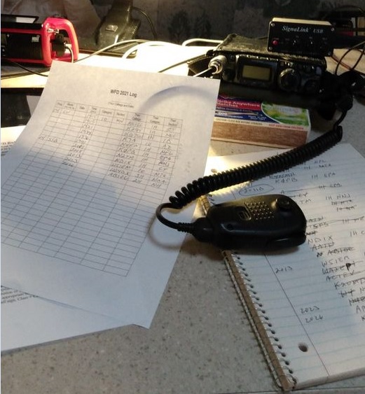
My station consisted of my Yaesu FT-817 powered by a fish-finder battery, which still had plenty of charge left at the end of the contest.  The one digital contact was made possible with the Signalink USB interface, which performed flawlessly with the inexpensive RCA tablet computer.  For some reason, the tablet’s keyboard didn’t work very well with the DroidPSK software, so I had to use the touchscreen, which seemed like a rather laborious process to me.  I probably could have made the process much easier by setting up some macros in advance.  But for the first time using it, I was glad that I was able to make my first ever portable digital contact.

As you can see in the picture above, I needed something to prop up the radio on the table, and a box of matches did a perfect job with this important task.

Am I going to save any lives with my ability to operate a portable station?  Almost certainly not.  On the other hand, if there is ever an emergency, large or small, that makes other forms of communication impossible, I know that I am able to send messages to friends and relatives in other states.  I can do it formally by checking in to a National Traffic System net, or I can do it informally simply by working someone and asking them to make a phone call or send an e-mail for me.  I can also do that for neighbors who want to let their friends in other states know that they’re safe.  I’m also well equipped to receive information from the outside world simply by knowing that I can power up a broadcast receiver to listen to either local or distant stations.  It’s unlikely that I’ll ever have a need, but it’s good to know that I have the ability.

The point of exercises like Field Day is to show that hams can adapt to emergency situations and still be able to communicate.  COVID has shown us that there are some emergencies where you are cut off from the group that normally helps you establish communications.  Can you adapt and still communicate if you are cut off from both this group and your normal station setup?  Field Day and Winter Field Day during COVID gave me the opportunity to show that I can.

Here’s a short video tour of my setup:


Some links on this page are affiliate links, meaning that this site earns a small commission if you make a purchase after clicking on the link.


1970 Multiband Mobile Antenna

1970AugustPE

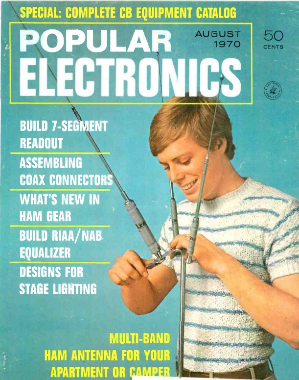
1970AugustPE2This month marks the 50th birthday of a pretty good idea, as evidenced by the cover story in the August 1970 issue of Popular Electronics. The article was penned by Russ Alexander, W6IEL, who was likely the originator. The article specifically addresses how to use a compact antenna from an apartment, and it makes use of Hustler mobile antennas.

The Hustler antenna is still available today, in more or less identical form. It amounts to a center loaded vertical antenna. The bottom half is a mast that attaches to the car. On top of that is a loading coil, and on top of that is a whip antenna. The loading coil and whip are tuned to a specific band. And because you need different coils and whips for different bands, the coil and whip are sold as a one-piece resonator.

So it’s fairly easy to change bands: You stop the car, get out, and swap out the resonator. But that doesn’t work very well if the antenna is mounted on the roof of your apartment building. And it doesn’t work very well if you want to change bands without getting out of the car.

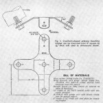
1970AugustPE3So the author went to his metal shop, and made a piece which allowed him to mount up to four resonators on the same mast. For bands that are not being used, the coil acts as a trap, so the unused resonators have little impact on the transmitted signal.

The idea caught on. I first remember seeing one of these as a young ham in the 1970s in the parking lot at a hamfest on the car of prominent Minnesota ham Tod Olson, K0TO (then W0IYP). I remember thinking that it was a pretty good idea. Chances are, it originated with the magazine article shown here.

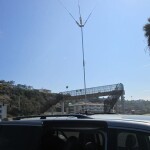
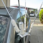
W6LENShown in these pictures W6LEN2is the mobile antenna of W6LEN, an avid WWFF activator of Southern California parks and beaches. He uses the Hustler mobile antenna on a magnetic mount on top of his minivan. While the magnetic mount is probably too small to use in motion, he has had good success with this antenna, and it takes only a few minutes to deploy when he arrives at his destination.  As with the 1970 article, he uses a homemade bracket to mount the four resonators.

Hustler eventually realized that using multiple resonators was a good idea, and they now sell the part, shown at right, so you don’t have to have your own metalworking tools. The author of the 1970 article recommended having the part plated with copper and then cadmium, after which “the finished bracket will look like a commercially marketed item.”  The 1970 Popular Electronics version had room for four resonators, whereas the commercial product has only three wings.  However, a fourth resonator can be added in the middle.


Post-Eclipse Report

Minutes after totality.

Minutes after totality.

The total solar eclipse was awesome, and well worth the trip to Hastings, Nebraska!

Travel Report

We left Minnesota on Saturday and drove to Fremont, Nebraska.  The traffic was noticeably heavy on both Interstate 35 and Interstate 80.  Many of the vehicles we saw were obviously eclipse chasers, with cars packed full of camping gear.  The heavy traffic was very apparent when we turned off onto I-680 to get to our hotel room in Fremont.  That highway was deserted, which appeared all the more eerie after witnessing the extremely heavy traffic directly on the route to the path of totality.  On Sunday, traffic was heavier still as we moved back onto the interstate, but was still moving at posted speeds.

We were in position by Monday, so we didn’t experience traffic the day of the eclipse.  It was reported to be heavy, but with no major delays.  The only eclipse-related traffic issue was an announcement on the radio that the Nebraska Highway Patrol had closed both I-80 rest areas near Grand Island for safety reasons.  Gasoline and other supplies were readily available at normal prices.

According to reports, traffic was heaviest after the eclipse as hundreds of thousands of visitors headed home.  Still, no major issues were reported, and traffic, while somewhat slower than normal, was moving along well.  We drove home Tuesday.  While traffic appeared normal by the time we were on the road, many cars were obviously those of other eclipse chasers, as evidenced by the camping gear filling many of them.

Viewing the Eclipse

The eclipse in Grand Island. NBC Nebraska.

The eclipse in Grand Island. NBC Nebraska.

On Monday morning, we set up in American Legion Park in Hastings, a small city park just across the street from our hotel.  Other viewing areas were packed, but we shared the park with only about a dozen other visitors, mostly from Minnesota, Wisconsin, and Iowa.   There were street lights on the neighboring road, but we stayed clear of them and they didn’t present any obstacle to our viewing.

We didn’t bother trying to take photos of the eclipse.  We only had two minutes, so rather than fiddling with cameras during that time, we simply enjoyed the spectacle and left the photography to professionals.

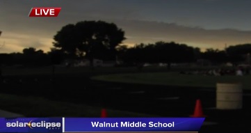
The best representation I’ve seen so far of what we experienced is from NBC Nebraska at this link.  if you click on Part 3 of the video at that link, and then advance to the 4:00 minute mark, you’ll see a live report from a Middle School in Grand Island, about 20 miles north of where we were.  The video does a good job of capturing the darkness of the sky, as well as the reaction of those present.  The video doesn’t do justice to the corona itself, but all of the other elements reflect very well what we witnessed.
It’s also evident from the video what I kept saying before the eclipse: The eclipse was something that kids needed to see!  The reaction of the middle school kids in this video was overwhelming, and the eclipse is something that they will never forget.  It’s a shame that some schools locked their kids inside rather than taking them to see it.  There are now undoubtedly many future astronomers and scientists among the kids in Grand Island and other places where enlightened educators made it a unique learning experience.  The kids who were left inside for the eclipse did not get that inspiration, and any school administrators who took that approach should be ashamed of themselves.

In Hastings, there were thin scattered clouds throughout the morning.  However, with the cooling caused by the eclipse, the sky was clear during totality, the clouds not reappearing until about 10 minutes later.   It was noticeably cooler starting a few minutes before totality.  Even though the surroundings were not noticeably dimmer to the human eye until just before totality, the direct sunlight didn’t feel warm as it had in the morning.

We saw the diamond ring both before and after totality.  I did not see Bailey’s Beads, nor did I see any shadow bands.  The horizon in all directions had the orange glow of sunset.  Venus was plainly visible.  I didn’t notice it before totality, but it persisted for a couple of minutes after the sun returned.

Radio Experiments

EclipseQSOPartyAs shown here, I was doing my part for science by operating in the HamSci Solar Eclipse QSO Party.  Along with other amateur radio operators, I was operating in this event to generate data which researchers will use to understand the ionosphere and how it was affected by the eclipse.  Radio signals are reflected by the ionosphere, and the effect varies depending on frequency, and depending on the amount of solar energy hitting the ionosphere.  The eclipse gave a rare opportunity to show the effects when the amount of solar energy varies over small areas, such as the path of totality.  I concentrated mainly on making short transmissions to be picked up by remote receivers.  Some of these receivers are connected in real time to the Reverse Beacon Network, which displays received signals almost immediately on the Internet.  Unfortunately, my signals were not picked up by these stations, but other software-defined receivers were continuously recording the radio spectrum, and it’s likely that my transmissions were recorded and will be available at a later date.

I didn’t spend much time trying to make two-way radio contacts, but I did make three contacts, which are shown on this map:

seqpmap

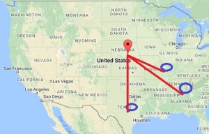
All three of these contacts were made before totality.  I was operating on the 40 meter band (7 MHz) with only 5 watts of power, and the distances of these contacts does seem much greater than would normally be expected that time of day.  The most distant contact was with WA1FCN in Cordova, Alabama, 776 miles from my location in Hastings, Nebraska.  We made this contact at 12:29 PM local time, about 30 minutes before totality.  It seems likely that this contact was possible only because of the eclipse.  The contact with N5AW in Burnet, Texas, 680 miles away, was made at 12:10 local time, and the contact with W0ECC in St. Charles, Missouri, 438 miles away, was made at 11:08 local time.  In all three cases, the partial eclipse was underway at both locations when we made our contacts.

The HamSci researchers at Virginia Tech will have a lot of data to analyze, but I think it’s clear that the eclipse was having an effect on propagation.  The 40 meter band is generally limited to shorter distances during the day, and the path lengths here seem more consistent with the type of propagation normally seen in the evening.

For those who are interested in the details, my station consisted of my 5 watt Yaesu FT-817 powered by a 12 volt fish finder battery.  The antenna was a 40 meter inverted vee with its peak about 15 feet off the ground, supported by my golf ball retriever.  The two ends of the antenna were supported by tent stakes in the ground.  The station was similar to what I used in 2016 for many of my National Parks On The Air activations. The antenna was running north-south in an effort to have its maximum signal along the east-west path of totality.  Since the antenna had an acceptable match on 15 and 6 meters, I also made a few test transmissions on those bands, although I concentrated on 40 meters.

Nebraska and the Eclipse

The State of Nebraska, the City of Hastings, and all of the other towns we encountered along the way, did an excellent job of planning for the eclipse and accommodating all of the visitors.  While traffic was very heavy, there were no real problems.  The staff of our hotel, the C3 Hotel & Convention Center, was extremely well prepared for what was probably the hotel’s busiest night ever.  The accommodations were excellent!

Since virtually all of the hotel rooms in the state were filled, dozens of temporary campgrounds sprung up, and visitors were able to find safe campsites at a reasonable price as homeowners, farmers, and ranchers opened their land for camping.

The only traffic-related problem that I’m aware of was the closure of two highway rest areas shortly before totality.  Unrelated to the eclipse, the City of Seward, Nebraska, experienced an ill-timed water main leak, leaving the city without drinking water during the eclipse.  We did see units of the Nebraska National Guard on the road, but as far as I know, other than to distribute drinking water in Seward, their services were not needed during the eclipse.

The entire state deserves high marks for its preparations in making the eclipse an unforgettable event for the hundreds of thousands of visitors.

Get your Eclipse Glasses for 2024 at:  MyEclipseGlasses.com


1937 Field Day

1937FieldDay

This weekend was Field Day, an activity in which Amateur Radio Operators set up portable equipment and make as many contacts as possible during a 24 hour period.

My own effort this year was very minimalist. I operated as I did for most of my National Parks On The Air (NPOTA) activations, with my 5 watt Yaesu FT-817  with a Hamstick antenna mounted on the car. I only operated for about an hour, but made 13 CW (Morse Code) contacts to places such as Quebec, Florida, Kentucky, and North Dakota. My power supply consisted of my 12 volt fish finder battery,

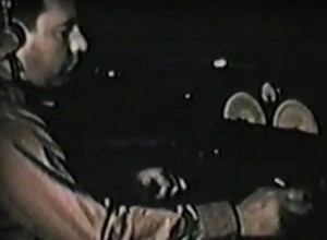
Back in the day, both the equipment and the power supplies were much more intimidating, and a successful Field Day operation almost required a team effort. This video shows Field Day eighty years ago in 1937. The film shows W8NCD/8, the Charleston (WV) Amateur Radio Club. It is narrated by W8NCD, who is now a Silent Key.

Field Day has always been primarily a fun social activity, but it also has a serious side. It shows that amateurs are ready for emergency situations. In 1937, hams were able to set up at a remote location, without external electric power or any other infrastructure, and be in contact with the rest of the world. In 1937, there weren’t any cell phone towers, but hams managed to communicate around the world. Today, there are cell phones available, but in the location I was at today, at the bottom of the St. Croix River Valley at William O’Brien State Park, cell service is not available. But with five minutes of setup, I was on the air and communicating, just like they were in 1937


NPOTA and WWFF

The ARRL National Parks On The Air (NPOTA) event concluded on December 31, 2016. During this year-long event to celebrate the 100th anniversary of the National Park Service (NPS), Amateur Radio operators set up their stations in NPS units to make contacts with other stations at home.

1494 hams participated as “activators” by setting up stations in the parks, and almost 17,000 participated by making contacts with them. A total of just over 1.1 million individual two-way contacts resulted. I closed out the year with a total of 59 activations, putting me in 64th place nationwide. I made contact with 329 different parks, giving me a ranking of 386th place out of those 17,000.

The March 2017 issue of QST contains an excellent article summarizing the year’s activity, and it is available for free PDF download at the ARRL website.

Even though NPOTA has now ended, there was a great deal of interest in continuing it in some fashion.  The activity isn’t as frenzied, but many hams are continuing to get out to the parks and do activations as part of World Wide Flora and Fauna in Amateur Radio (WWFF).  WWFF is a very similar concept to NPOTA, but as the name implies, it is worldwide.

The program got its start in about 2008 in Russia by the Russian Robinson Club, and has been very popular in Australia and Europe.  During my activations, there were a number of familiar European stations who kept working me, undoubtedly as part of the WWFF program.  With the tie-in to NPOTA, the North American chapter of WWFF has achieved similar popularity.

While NPOTA focused on National Parks and other NPS properties, WWFF includes many other parks, including most state parks in the United States. I haven’t been on the air yet from the parks, but in addition to the local NPS units I was able to activate in 2016, I can now do similar operations from other metro area locations, such as William O’Brien State Park, Fort Snelling State Park, and Afton State Park, as well as from most of the other state parks in Minnesota and surrounding states.

Most of my activations during 2016 focused on metro-area parks, but some of them, such as my activations of the Lewis & Clark Trail and the Herbert Hoover National Historic Site, were done in conjunction with business travel.  Great minds obviously think alike, as shown by Vance, N3VEM‘s recent activation of a metropolitan park in Florida while traveling for business.

n3vemStation

Photo courtesy of N3VEM.

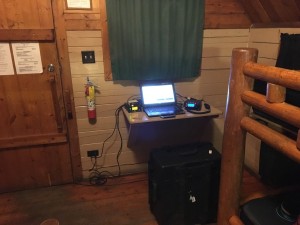
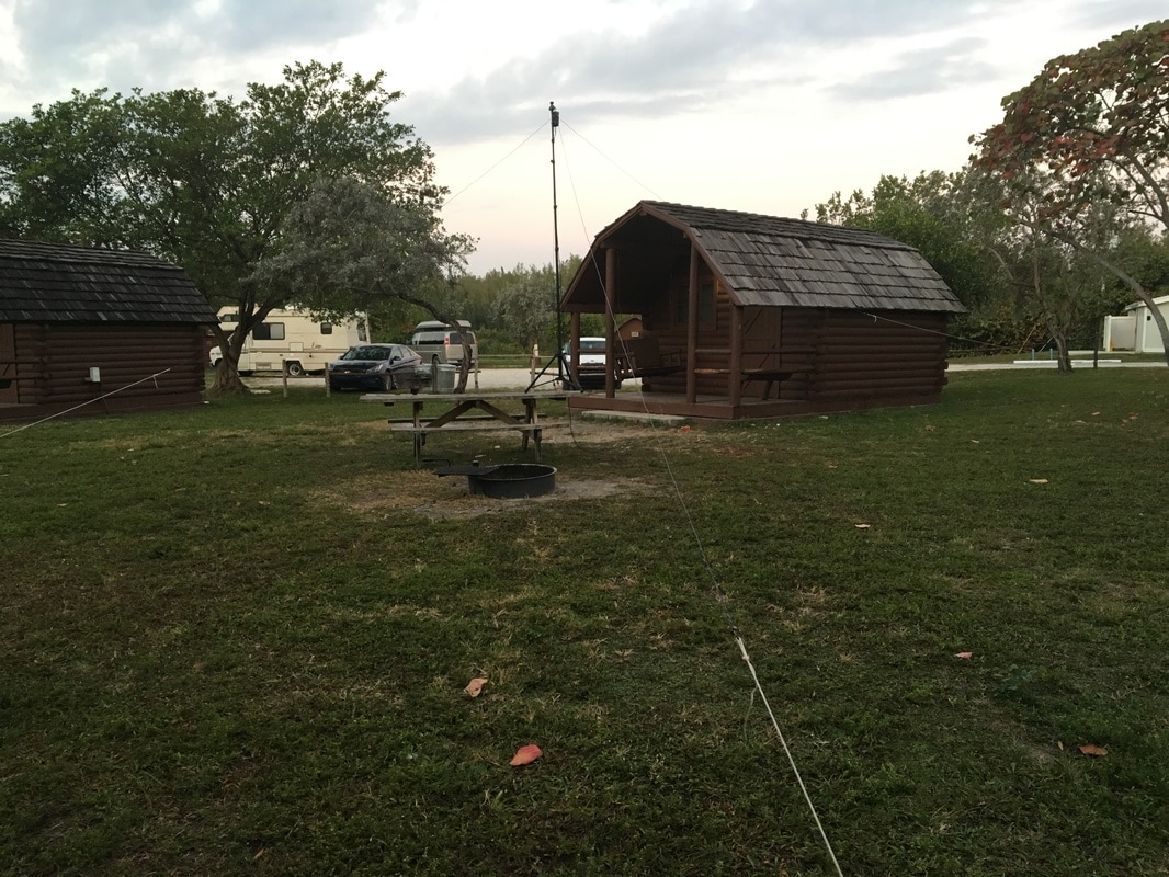
As he details at his blog, he recently had a business trip to Florida from his home in Pennsylvania. He immediately began researching parks in the area, and discovered Oleta River State Park, which is actually located minutes from downtown Miami. Rather than book a stay in a more conventional hotel, he rented a rustic cabin at the park, which allowed him do his activation after work.  He packed his FT-857, which is almost identical to the FT-817 I used for most of my activations, the difference being that his radio puts out 100 watts as opposed to my 5 watts.  His complete station set up in the cabin is shown at the left.  His antenna consisted of dipoles for 40 and 20, shown below.
n3vemAntenna

Photo courtesy of N3VEM.

One of the major successes of the NPOTA program was to encourage hams to learn new operating techniques.  In particular, many hams discovered that Morse code (CW) can be extremely effective if conditions are marginal or if the station is less than optimum.  Because NPOTA focused on portable operations, most of the activators were using stations that were less than optimal.  For that reason, more than one ham discovered or rediscovered how effective CW can be, even with extremely simple equipment.

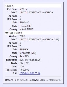
n3vemQSOIt looks like that tradition is continuing with WWFF, since N3VEM became one of the hams to discover CW.  Vance has been licensed only since 2014, and by the time he got his license, the requirement to pass a code test to get a license had been gone for a number of years.  But even though it’s no longer required, it’s still permitted, and he used this activation to make his first ever CW contacts.  And his very first CW contact was with me!

To show how versatile CW can be, it should be pointed out that Vance didn’t even have a key with him.  But like my radio, his allows the microphone to be used as an emergency key, and he used the mike buttons to send the dots and dashes.  When I worked him, the band conditions between Florida and Minnesota were very poor, and I could barely hear his signal.  It would have been absolutely impossible to work him using voice.  But with CW, it was a fairly easy contact, despite his signal being almost completely buried in the noise.

Our first CW QSO was very slow, probably about 5 words per minute.  But I’m sure he’ll discover that speed will increase rapidly as he gets on the air, and I have no doubt that I’ll have future CW QSO’s with him.


Peace Light and NPOTA: Herbert Hoover National Historic Site

img_20161201_163719


I was recently in Iowa to present some Continuing Legal Education programs in Cedar Rapids and Des Moines.  Whenever possible, I like to combine trips, and I used this opportunity to take part in two other events.

Cedar Rapids is close to the birthplace of Herbert Hoover in West Branch, Iowa.  It is the location of the Herbert Hoover National Historic Site, as well as the Hoover Presidential Library and Museum.  I’ve been looking forward to putting this National Park Service (NPS) unit on the air during the NPS Centenial year as part of the  ARRL National Parks On The Air (NPOTA) event.  During this event,  Amateur Radio operators are setting up their equipment in NPS units  to make contact with other Amateurs around the world.  Since the beginning of the year, the event has been extremely popular.  There have been over 900,000 individual two-way contacts made from the parks, and it appears almost certain that this number will top a million before the end of the year.  As I’ve reported in other posts, I’ve made contact with over 300 different parks and operated multiple times from parks in Minnesota, Wisconsin, and Iowa.

I was especially eager to operate from President Hoover’s birthplace, since he played such an important role in the history of radio.  Indeed, his son was an avid amateur radio operator, and served in the 1960’s as president of the American Radio Relay League, the national organization sponsoring the event.

img_20161201_164804I didn’t have time for a long operation, but I was able to spend about an hour operating from the parking lot of the historic site’s visitor center, as shown in the photo above.  President Hoover’s birthplace home is barely visible in the photo (just to the left of the larger building in front of the car.  Despite the short time available, I managed to make contact with about 30 stations, all CW (Morse Code), ranging from Alaska to Florida.  After operating, at dusk, I paid my respects at the gravesite of President and Mrs. Hoover, shown here.

img_20161203_145243The next day, I used my drive home to the Twin Cities to transport the Peace Light of Bethlehem from Des Moines to the Twin Cities.

For at least the past several hundred years, and possibly more than a thousand, a lamp has continuously burned at the grotto of the Church of the Nativity in Bethlehem, the traditionally accepted location of Christ’s birth.  Since 1989, the Boy Scouts and Girl Guides of Austria have annually sent a child to Bethlehem, who lights a lamp from the light and returns it to Austria.  From there, it is passed on around Europe during the Advent season.  Since 2000, the Peace Light has been delivered to North America where volunteers, most of whom are connected with Scouting, deliver it around the country.

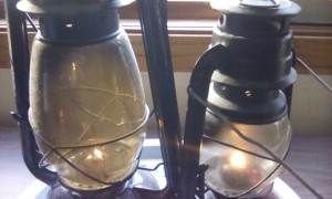
This year, there was a gap in the distribution, and it wasn’t making it to the northern tier of states.  I coordinated with members of the Peace Light North America Facebook group, and made arrangements to meet with an Iowa Scouter in the parking lot of a Des Moines coffee shop.  From his kerosene lantern, we lit my lanterns, shown here, and I took the burning lanterns home.

From there, others have come to light their candles and lanterns, and the same ancient flame is burning in lamps in Minnesota and Wisconsin.  Another volunteer from North Dakota is on the way here, and within a few days, the Peace Light will be burning in North Dakota, Manitoba, Montana, Washington, and probably other places along the way.

Many are curious as to how the Peace Light crosses the Atlantic.  It is transported by Austrian Airlines in the passenger cabin of an aircraft.  The ailine transports the flame from Israel to Austria, and then to New York and Toronto.  The flame is held within a blastproof miner’s lamp, which allows the open flame to be transported safely by air.  At Kennedy Airport, it’s walked through customs by an airline employee to the airport chapel, where a ceremony is held attended by those who fan out around the country to transport it.  Among those were one or more volunteers who transported it to Chicago.  From there, it went to Davenport, Iowa, where it was picked up by the person who gave it to me.

B


NPOTA: Lewis & Clark National Historic Trail

dsc01378

Preparing to send RF ‘cross the wide Missouri.

During the 2016  ARRL National Parks On The Air (NPOTA) event,  Amateur Radio operators are celebrating the 100th anniversary of the National Park Service (NPS) by setting up their equipment in NPS units  to make contact with other Amateurs around the world.  Since the beginning of the year, the event has been extremely popular, with over 13,000 activations from 450 different different units of the NPS and over 700,000 individual two-way contacts.  As I’ve reported in other posts, I’ve made contact with 281 different parks and operated multiple times from six parks in Minnesota and Wisconsin.

One of the event’s successes has been encouraging visits to the parks.  Until recently, my activations have been confined to the NPS units in Minnesota and Wisconsin.  Last week, I had to be in Sioux City, Iowa, for one of my continuing legal education programs.  The city lies along the path taken by Lewis and Clark as the traveled from St. Louis to the Pacific Ocean, and is therefore part of an NPS unit, the Lewis and Clark National Historic Trail.  Because the trail’s sheer length, and because it passes through so many other notable sites, it is the NPOTA’s most popular activation site, with over 13,000 individual contacts made.  Since my son had recently been studying Lewis and Clark in school, I decided to bring him along.

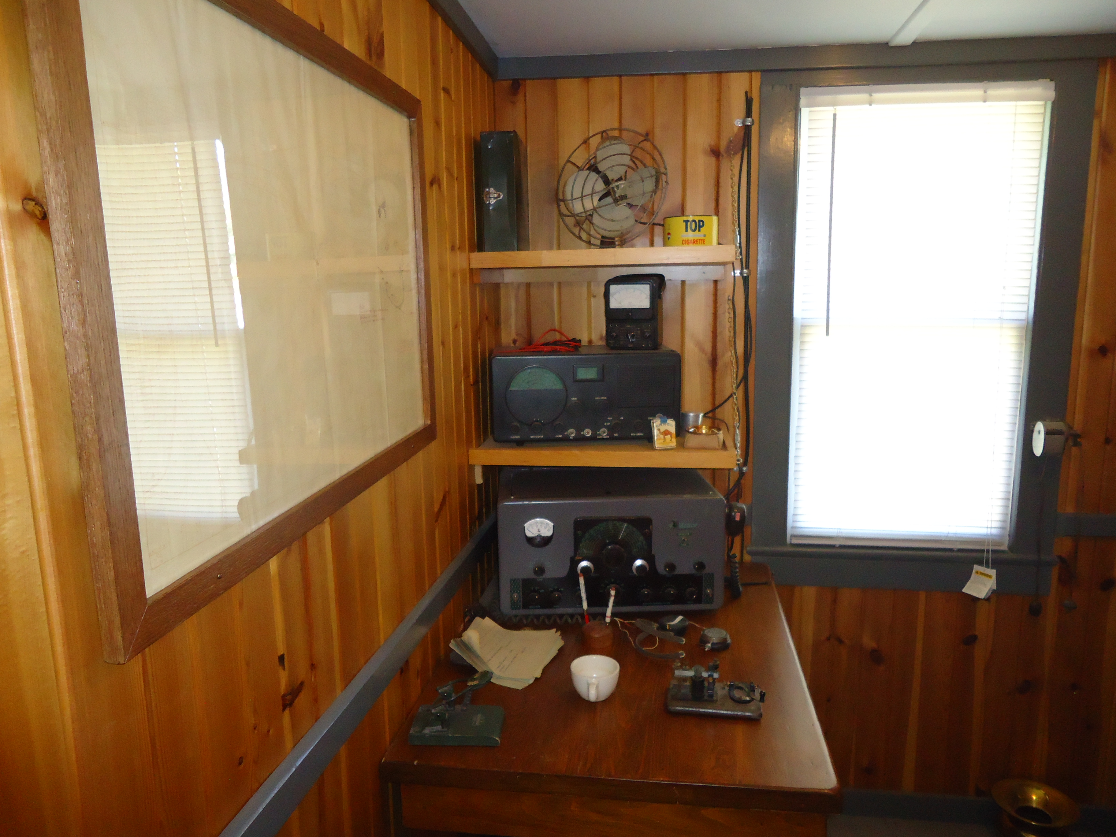
Sioux City marks the point where the only death during the 1804-06 Corps of Discovery’s expedition took place.  Sgt. Charles Floyd is buried under a prominent obelisk on a bluff overlooking the river.  The Sioux City riverfront contains two museums devoted to Lewis and Clark’s journey.  The first is in a drydocked former riverboat, the M/V Sergeant Floyd.  The ship was an Army Corps of Engineers Inspection Vessel.  Interestingly, the ship contains a ham station, although it’s supposed to be a recreation of the ship’s radio room.  As you can see from the photo below, the radio room is equipped with an E.F. Johnson Viking Valiant and a Hallicrafters S-40.  Even though these amateur rigs appear to be out of place, it was interesting to see this inadvertent ham station set up.

dsc01372

dsc01371The museum also contains the forensic reconstruction of Sgt. Floyd shown here, created from a plaster cast of his skull.

The second museum on the riverfront is the Sioux City Lewis & Clark Interpretive Center, which includes animatronic versions of Lewis, Clark, President Jefferson. and “Seaman,” the expedition’s Newfoundland dog.

Conditions were relatively poor the day I visited the site, and my initial attempt with a mobile antenna was unsuccessful.  Since the day was nice, I returned and set up a dipole at a picnic shelter overlooking the river and made ten contacts on 20 meter CW.

Read More at Amazon


National Parks On The Air: Appalachian Trail

1941oct13life

During 2016, the American Radio Relay League (ARRL) is conducting its National Parks On The Air (NPOTA) event, in which  Amateur Radio operators set up their equipment in units of the National Park Service (NPS) to make contact with other Amateurs around the world.  Since the beginning of the year, the event has been extremely popular, with over 13,000 activations from 450 different different units of the NPS and over 700,000 individual two-way contacts.  As I’ve reported in other posts, I’ve made contact with 278 different parks, operated multiple times from six parks in Minnesota and Wisconsin, and plan to activate additional parks in the Midwest before the end of the year.

One of the surprises of this event has been the popularity of the National Scenic Trails.  I’ve operated from two, the North Country National Scenic Trail and the Ice Age National Scenic Trail.  These operations are a bit more challenging, since the event rules require all equipment to be hand carried to the operating location, rather than operating from a vehicle.  I would have expected this restriction to make the scenic trails less popular, but the reality has been quite different.  In fact, two scenic trails are in the top ten of parks activated.  The North Country Trail has seen 249 activations with 9932 individual contacts, and the Appalachian Trail has had 239 activations with a total of 6700 contacts.

The Appalachian Trail is probably the most famous of the nation’s National Scenic Trails.  It runs 2130 miles from Georgia to Maine.  I’ve made a number of contacts with stations on the trail.  Some of them were with small stations carried during long multiple day hikes.  Others were located closer to civilization,

(C) Copyright 2016 Tim Carter All Rights Reserved. Used by permission.

(C) Copyright 2016 Tim Carter All Rights Reserved. Used by permission.

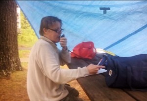
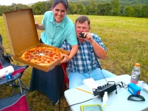
Shown here is one of those in the latter category (as judged by the availability of pizza rather than dehydrated meals)  by Emily, KB3VVE, Keith, KB3FVN, and Tim, W3ATB, operating on a section of the trail in Pennsylvania.

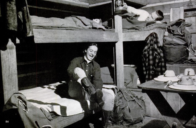
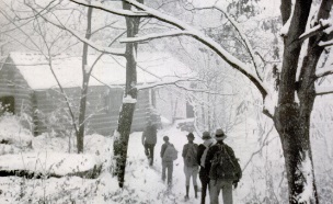
Seventy-five years ago, 1941oct13life1this day’s issue of Life Magazine, October 13, 1941, carried a feature on the Appalachian Trail. The photo at the top of this post, a cabin along the trail at Shenandoah National Park, is from that article.   The photo at the right shows those same hikers approaching the cabin after an October snowstorm.  According to the article, the trail was completed in 1937.  As of 1941, only four persons had hiked the entire trail, but none of them had done so in a single uninterrupted session.  In contrast, thousands of hikers now hike the entire length of the trail each year.