Category Archives: Radio

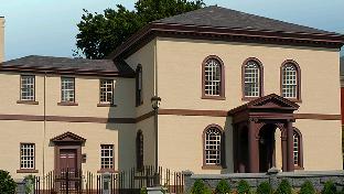
NPOTA: Touro Synagogue, Rhode Island

Touro Synagogue. National Park Service photo.

Touro Synagogue. National Park Service photo.

During the ARRL National Parks On The Air (NPOTA) event, Amateur Radio operators are setting up their stations in various units of the National Park Service (NPS) and making contact with other Amateurs around the world. Since the beginning of the year, there have been over 9000 activations from 444 different different units of the NPS (with only 44 not yet activated), with over a half million individual contacts.

One interesting aspect of this event is learning about the different parks, some of which I did not even know existed.   For example, in an earlier post, I wrote about the fascinating history of Kalaupapa National Historical Park in Hawaii, a remote settlement originally set aside for persons suffering from leprosy.

Synagogue interior. Wikipedia photo.

This week, I learned, by talking to someone there, of another important site in American history, Touro Synagogue National Historic Site in Newport, Rhode Island.  In addition to being the oldest synagogue in the United States, the site is important as a symbol of religious liberty for all Americans.  The synagogue still houses an active congregation, Congregation Jeshuat Israel, as it has since 1763.  It was designated a National Historic Site in 1946, and is an affiliated area of the National Park Service.

The congregation itself was founded in 1658.  The ancestors of the founders had fled Europe for the Caribbean in search of religious freedom, and the founders of the synagogue ultimately fled to Rhode Island for even greater liberty.  It was well established by 1790, when President George Washington wrote his letter to the “Hebrew congregation at Newport,” in which he vowed that the new nation would give “to bigotry no sanction and to persecution no assistance.”

The congregation does an annual reading of President Washington’s letter, the next scheduled for August 21, 2016.

This week, the park was put on the air by students from Rogers High School Ham Radio Club, W1VRC.  Most national parks can be easily “activated” by individual hams simply pulling in and operating from a parking lot or picnic table.  But many culturally sensitive sites, such as this synagogue, require more advance planning, and W1VRC worked with the site to do an activation that was both sensitive to the site, and also well planned from a radio point of view.  With their advance planning, they were able to put up a 132 foot long Windom antenna, that put out an effective signal but was unobtrusive.

In sanctioning the activation, the Synagogue found especially compelling the youth involvement as the students made contacts.  The young operators all did an excellent job, and there were many compliments as to their professionalism as they  made 185 contacts, including one with me.  This operation was actually a trial run for a larger activation, which will take place on August 7, 2016.  If you’re a ham, I encourage you to try to work them.  The best place for up-to-date information on frequencies is the NPOTA Facebook group. More information about W1VRC’s activation is also available at the school’s website.

Read More At Amazon


Click Here For Today’s Ripley’s Believe It Or Not Cartoon


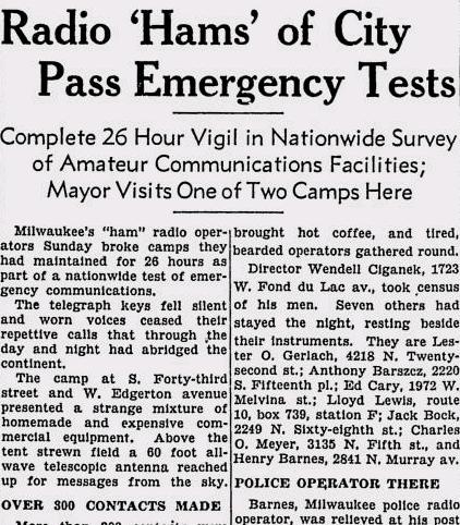
Field Day 1941

19410609MilwSentinel

Seventy-five years ago, this day’s issue of the Milwaukee Sentinel, June 9, 1941, carried this report of ARRL Field Day, which had just concluded.

The Milwaukee hams had operated for 26 hours from a location at 43rd Street and West Edgerton Avenue in Milwaukee, a site which “presented a strange mixture of homemade and expensive commercial equipment. Above the tent strewn field a 60 foot all-wave telescopic antenna reached up for messages from the sky.”

The article reported that 291 contacts were made with all nine call areas. The furthest contact was with Puerto Rico. The paper noted that this was a test of emergency communications, and demonstrated how Milwaukee would reach the outside world should catastrophe wipe out power and telephone lines.

This was to be the last pre-war Field Day, with Amateur Radio operation silenced after Pearl Harbor. In 1940, the FCC had severely restricted portable operation, restricting it to weekends, only with self-powered apparatus intended for emergency use. 48 hour advance notice was also required. At the ARRL’s request, the FCC relaxed these requirements in a March 11, 1941 order:

It Is Ordered, That during the period of the American Radio Relay League Field Day test from 4:00 P.M. E.S.T., June 7, 1941, to 6:00 P.M. E.S.T., June 8, 1941, the prohibition contained in Commission Order No. 73 shall not apply to communications transmitted by licensed portable and portable-mobile stations participating in such tests.

The announcement of this order in the May 1941 issue cautioned that the relaxation applied only to stations participating in Field Day.

Results were published in the January 1941 issue of QST, and noted that at least 2180 individuals had participated from 163 club stations and 119 non-club stations.  The Milwaukee group’s showing was overshadowed by the Tri-County Radio Association of Plainfield, NJ, W2GW/2, with 1112 contacts.  That club’s contacts were evenly split between CW and phone.  They had 163 worked on 160 meters, 447 on 80 meters, 245 on 40 meters, 32 on 10 meters, 20 on 5 meters, and 61 on 2-1/2 meters.

Like most Amateur Radio traditions, Field Day resumed after the war.  This year’s running will take place on June 25-26.  The event has continued to grow over the years.  In the 2015 running, the high scorer, Potomic Valley Radio Club and Columbia Amateur Radio Association, W3AO, logged a total of 9700 contacts from 18 transmitters.

Click Here For Today’s Ripley’s Believe It Or Not Cartoon


NPOTA: National Trails Day from Jay Cooke State Park, MN

TR04aJune 4, 2016 was American Hiking Society’s National Trails Day®.  Since many trails are units of the National Park Service, they are taking part in National Parks On The Air (NPOTA), an event in which amateur radio operators set up portable stations at National Park units and make contact with other amateurs at home.  The event has been very popular, and there have been hundreds of thousands of contacts made from the parks.  The North Country National Scenic Trail qualifies as a “National Park,” allowing me to operate from one of the Minnesota state parks crossed by the trail.  The North Country Trail extends from eastern New York to North Dakota.  As the trail passes through Minnesota, it becomes the Superior Hiking Trail, which runs from Jay Cooke State Park along the north shore of Lake Superior to Grand Portage.

On National Trails Day, a group of hams put together an event called  Light Up The Trail in which stations were set up at various locations in all of the states along the North Country Trail.  As I did a couple of weeks ago, I operated from Jay Cooke State Park in Minnesota, about 25 miles south of Duluth.

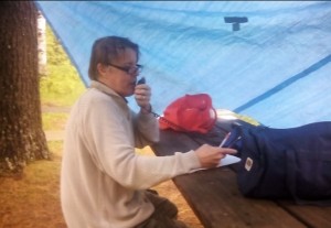
The weather wasn’t quite as cooperative as it had been with my previous activation, since there was a light rain when my son and I arrived at the park.  Undaunted, we moved a picnic table close to two trees what would serve as a support for a tarp.  I used my trusty golf ball retriever as a tent pole on one corner, and secured the other corner to the table itself.  A few taut line hitches had the protective shelter up in a few minutes, and I was ready to get on the air.  My original plan was to set up dipoles for 40 and 20 meters, but with the rain coming down, I decided to stick to 20 meters only, since the total antenna length was only 32 feet.  I used an inverted vee with the center supported by the golf ball retriever, and the ends tied to a tree and another picnic table.  The radio consisted of my  Yaesu FT-817, powered by a 12 volt sealed lead acid fish finder battery,

Old fort at Crown Point, New York, the eastern terminus of the North Country Trail, and my first contact. Wikipedia photo.

The activation was shorter than I had planned, but I managed 16 contacts in less than an hour of operating.  My very first contact was with N1NDN who came back to my voice CQ from the eastern end of the trail at Crown Point State Park on Lake Champlain, New York.  He had a very good signal, and didn’t seem to have any trouble copying my 5 watt signal.  I also made contacts with two other parks, W3OK at Delaware Water Gap National Recreation Area, and W5NO at Gulf Islands National Seashore.

My last contact was with AA0AW, who was operating from the North Country Trail in Duluth.  After packing up, we made a short stop at their location for an “eyeball QSO.”  A group of Duluth hams had a large multi-operator operation, and had worked about 150 contacts by the time we stopped by.

Swinging Bridge prior to 2012 flood. Wikipedia photo.

The site from which I was operating,  Jay Cooke State Park, lies next to a rapids of the St. Louis River. Because the rapids is impassible by canoe, it was the location of a portage used by both Native Americans and European fur traders, and remained in use until the 1870’s when a railroad was built in the area.   The portage was an important link between the Great Lakes and the Mississippi River.  From the portage, travelers could navigate the river to Savannah Portage, a six-mile link to the Mississippi watershed.  Jay Cooke park was formed in 1915 and remained largely undeveloped until the 1930’s when the Civilian Conservation Corps built a number of structures. I was right next to two of these. The most iconic structure in the park is the Swinging Bridge, a pedestrian bridge crossing the river. A

St. Louis River, just upstream from the park. Wikipedia photo.

rickety version was in place as early as 1924 (a picture is available at this site), until 1933 when the more substantial suspension bridge was built by the CCC.  That bridge endured until a massive flood in 2012, but the bridge has since been rebuilt to its 1930’s specifications.

River Inn Jay Cooke.JPG

River Inn Visitor Center, Jay Cooke State Park. Wikipedia photo.


My operating location was right behind the River Inn, a picnic shelter and small museum, also built by the CCC. I toyed with the idea of operating from inside the building, which had a roaring fire going in its fireplace. But unfortunately, there was no convenient way to get my antenna cable outside, so I decided to go with my expedient blue tarp.

Back of the River Inn from my operating location. The golf ball retriever is visible holding up the tarp and antenna.

Back of the River Inn from my operating location.  The golf ball retriever is visible holding up the tarp and antenna.

The 2012 flood which destroyed the bridge continues to have an impact.  Minnesota Highway 210, which serves as the access to the park (and has the distinction of being a Minnesota state highway running through a small section of Wisconsin) is still closed east of the park.  The $21.3 million reconstruction of the highway is scheduled to be completed in October 2016.

Here’s some raw video shot by my son, which will give you an idea of my operating location:


Click Here For Today’s Ripley’s Believe It Or Not Cartoon


Stealth Slinky Antenna

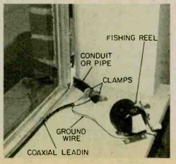
SlinkyAntenna1Forty years ago, the May-June issue of Elementary Electronics carried an interesting idea for a stealth antenna. While the article was aimed at SWL’s, the idea is equally intriguing for hams confronted with the need for a clandestine antenna.

I’ve operated with antennas hanging down from the side of a building. They’ve generally performed well, although depending on the type of construction, they often get out better in one direction. For short-term use, I generally just let a wire out through an open window and retract it when needed. The idea shown here automates the process a bit.


As you can see, the antenna itself consists of a Slinky®, mounted in a tin can just outside the window. To extend and retract it, it’s connected to an inexpensive fishing reel inside. To keep everything neat, there’s a piece of conduit running between the reel and the can. To deploy the antenna, you simply push the button on the reel. When you’re done with it, you simply reel it in. To keep prying eyes from noticing, the article recommends painting everything black.

Exterior portion of the antenna.

Exterior portion of the antenna.


Interior view.

Interior view.


Click Here For Today’s Ripley’s Believe It Or Not Cartoon


Tips for NPOTA Chasers and Activators

National Parks on the Air

After two and a half months, the ARRL’s National Parks On The Air (NPOTA) event has been a great success. As I’ve reported in earlier posts, the object is for amateur radio operators to operate from units of the National Park Service (NPS), and for hams at home to contact as many of those stations as possible. As of February 28, there have been a total of 136,539 confirmed contacts from 243 NPS units, with a total of 606 separate “activations.” As the spring and summer months approach, this number is sure to increase considerably. Many notable parks have not yet been activated. For example, Glacier National Park in Montana and Theodore Roosevelt National Park in North Dakota have not yet been on the air, but surely will with warmer weather.

Some sites, such as Isle Royale National Park, are currently inaccessible, and I know that activations are planned later in the year.

So far, even though I have yet to set foot inside an actual national park, I have made sixteen activations. This is because I live very close to two NPS units, the Mississippi National River and Recreation Area, and the St. Croix National Scenic Riverway. Because the NPOTA rules permit operation from within 100 feet of these rivers, I have been able to go to one of them with a portable transmitter and antenna on my car and activate them on short notice, such as over a lunch break. Others have made more contacts than I have, but I’ve made approximately 300. These included contacts as far away as Morocco and Cape Verde Island, and have been on the 40, 30, 20, 6, and 2 meter ham bands.

In addition, I’ve made contact with 125 different parks. These stats place me in 30th place nationwide out of 484 “activators,” and 208th place worldwide out of 6035 “chasers.”

In short, I’m not at the very top tier, and there are other experts more qualified than I am, but I do have enough experience to give some advice to both chasers and activators.

Tips For Chasers

Many of the activations result in huge pileups, and they can be somewhat daunting to a ham unaccustomed to them. However, even a very modest station is capable of working most of the parks on the air. You do not need to have a superstation! Most of the chasers have stations similar to mine, running about 100 watts to a wire antenna. Even stations with amps and large antennas don’t need them, and I’m guessing that the amp rarely gets turned on, even by those near the top of the leader board. If you have a kilowatt and a beam, great. But whether or not you do, it’s more important to rely on your skill.

The easiest way to beat a pileup is to avoid it entirely. If you get there before the pileup starts, you’ll get through with no problem at all. You’ll probably even have time to chat with the operator and learn about the park, rather than simply giving your signal report and state because others are waiting in line. And the way to avoid the pileup is to use your VFO knob and tune around the band listening for weak stations. Tune slowly, listen for weak signals, and see if they are saying “CQ National Parks On The Air.” Another sure fire way to spot a park is to listen for slightly stronger stations saying something like, “thanks for activating.” When you hear that, you know that there’s an activator on that frequency. And if they haven’t yet been spotted on the DX cluster, they will hear you. Remember, you don’t have a superstation, but your station is probably better than theirs. They are probably operating with low power, with a hastily set up antenna, and probably from a less than optimal radio location. If you can hear them, it’s almost guaranteed that they will be able to hear you very well, as long as you get there before the hundreds of other stations who will want to call them.

You can put yourself in this position by turning off the computer and tuning the radio dial. You’re more likely to find national park stations during the daylight hours. (I predict this will change in the summer, as NPS campgrounds fill up with hams working the lower bands throughout the night.)  There are somewhat more on weekends, but there are many on the air weekdays. If you simply tune the bands (20 and 40 are the most commonly used), you will make many contacts without having to worry about pileups.

If you are near your computer, when you work the station, ask the station whether they would like you to “spot” them on a site such as DXsummit.fi or on the NPOTA Facebook group. The operator will probably say yes, since that will almost guarantee that he or she will then get the required ten contacts.

I can’t stress the importance of tuning the bands. On numerous activations, I have been calling CQ NPOTA with absolutely no takers. It can seem as if the band is totally dead or that my radio is broken. Then, I’ll finally work one station. After about two minutes, my radio invariably explodes with dozens of stations calling me. I’m not any louder than I was before. But I later discover that the first station spotted me about a minute before the pileup started.

There will be times when you can’t avoid the pileup. Once an activator has been spotted, there will be a pileup, and if you want to work them, you’ll need to jump into the fray. If you keep calling and calling, and they keep coming back to other stations, it can seem like those other stations must have more power or a better antenna. But that’s rarely the case. The best way to break a pileup is not with power or big antennas, but with operator skill.

The first step is to listen. First of all, please follow any instructions given by the operator. If the operator is going “by the numbers,” and asking for 4’s to call, then please don’t call unless you have a 4 in your callsign. They won’t work you, and when it really is your turn, you might be ignored.

You also want to listen to figure out the best way to call. In particular, see how long it typically takes between the operator saying “QRZ” and when he or she takes the first call. If it’s a modest pileup, it might be just a second. If it’s a huge pileup, it might be several seconds. This is because everyone starts calling right at first. It’s usually totally indecipherable at that point, and the operator on the other end can’t make out any calls until things settle down a bit. The secret of getting through is giving your call right at the moment when things die down. So listen to a few exchanges, and see how long it takes. If the activator usually takes about 10 seconds to come back to someone, then wait about 9 seconds, and slowly give your call, one time, phonetically. Your call is the one that will get heard.

If the operator is coming back immediately, this means that the pileup has subsided, and you’re probably best giving your call quickly, one time, phonetically. It’s almost always best to give your full call, rather than just part of it.

Either way, after you have sent your call, listen carefully. If the activator comes back to you, then come right back with your report and state, and maybe a quick pleasantry.

I don’t have a kilowatt, and I don’t have a beam. With 100 watts and a dipole, I’m almost able to get through any pileup by using these tips. In fact, I’ve had a number of “park-to-park” contacts where I was running only 5 watts to a mobile antenna. I almost always had to get through a pileup to make these contacts. But with careful timing, it’s usually possible.

If you are looking for a particular chaser who you think will be using CW or PSK31, then it’s a good idea to check their call sign on the Reverse Beacon Network or PSK Reporter websites. As soon as they start calling CQ, the skimmers will pick them up, and you’ll be directed to their exact frequency. Chances are, you’ll get there long before the pileup.

And speaking of CW and digital modes, you will add to your totals by using one of these modes in addition to SSB.  Many of my activations have been CW only.  Most are phone only, but by using CW or digital, you have an edge over the other chasers who are using phone only.

Tips For Activators
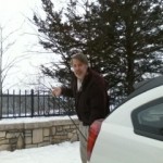
Setting up my superstation at WR09.

Setting up my superstation at WR09.

So far, all of my activations have been with 5 watts, running my  Yaesu FT-817 to a Hamstick antenna mounted on the back of my car. When the weather gets nicer, I’ll get out of the car and put up a bigger antenna. But you can be quite successful as an activator with a very modest station.

Your first step is to find a suitable location. Since the Mississippi and St. Croix Rivers span many miles, this hasn’t been difficult for me, and I’ve been able to scout out some good radio locations on bluffs overlooking the rivers. On the other hand, I’ve done some operating down near the water level, so even a site that is not optimal for radio will get out.

Whether or not to ask permission is something that you will need to consider on a case-by-case basis. If you’re operating from your car with no external antennas, then it’s probably not necessary if you’re in a legal parking spot. If you’re at a picnic table with a battery and free-standing antenna, then it’s still probably not necessary. If you’re going to install a crank-up tower right next to Old Faithful, then it probably is necessary.  It’s best to use your common sense in deciding whether you need to ask.

For most of my activations so far, I’ve not asked for any kind of permission. These were mobile operations from parking lots of city parks and a state rest area. Since I’m using the location (a parking lot) for its customary purpose (parking), I don’t believe there’s any need to ask permission. More importantly, there’s nobody to ask permission. I’m simply parking in a legal parking spot and sitting in my car. Occasionally, the police have driven through, but paid no attention to me.
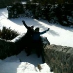
My assistants scouting out s location at AA11.

My assistants scouting out a location at AA11.

For an operation in a State Park, I did speak to the rangers beforehand, but that was mostly to let them know that I would be operating later in the year with portable antennas. While I was talking to them, I let them know that I would be operating from the parking lot that day, and they had no objections. The key is to be polite and professional.

To make it a successful activation, you need to make ten contacts. These contacts need to be entered on LOTW, but they do not need to be confirmed by the other station. This part of the event is based on the honor system. And there is also no need for the stations you work to be active “chasers.” You simply need to make ten contacts on any band or mode with ten other hams. The easiest way to accomplish this is to get yourself spotted. If you have internet access at your operating location, you can self-spot yourself on a site such as DXSummit.fi. In the comments, just put “NPOTA” and the unit number.

If you don’t have internet access, but do have cell phone access, another alternative is to call a friend and have them spot you. Or if you’re in an area with active repeaters, work another ham on the repeater and ask them to spot you. The repeater contact won’t count for NPOTA purposes, but it will get you spotted and get those additional contacts.

If you’re unable to use a cell phone or internet, or simply don’t want to rely on the spotting networks, then you’ll be on your own making your ten required contacts. But remember, there is no requirement that those ten contacts be with active chasers. And there’s certainly no requirement that those contacts be in response to your CQ. So in my most recent activations, I’ve discovered that the best strategy is to not worry about the spotting networks, and just tune the dial and make ten contacts with anyone, as soon as I get set up.

On a weekday, this can be challenging, becuase you might not find ten stations calling CQ. (However, keep in mind that there are almost always other NPOTA activators in the field, and they are calling CQ. On most of my excursions, I’ve worked one or two other NPOTA stations, and these count toward my ten.)  And I haven’t done it myself yet, but other hams have suggested the County Hunters Net. Whatever county you’re in (and you need to know what county you’re in), chances are, someone will be looking for it, and you will get some or all of your ten contacts that way.

On weekends, it’s almost always possible to get your ten contacts in short order, because there is almost always some kind of contest going on. In fact, there are occasional contests during the week. Before you head out, check the contest schedule to learn which contests to look for, and what exchange you need to give. Today, for example, the Virginia and Louisiana QSO parties were taking place, and there were many stations on the air in Louisiana and Virginia looking for contacts with anyone. I wound up making eleven contacts in the Russian DX contest. I checked the rules of that contest, and QSO’s with U.S. and Canadian stations counted for contest credit, so there were plenty of big gun stations eager to work me. During the ARRL International DX Contest, I even made a number of DX contacts, although they were tougher than domestic contacts.

You should try to find out the contest exchange before the constest. However, if you’re not sure, just give a signal report and your state. If the other operator needs something else, they’ll ask for it, and they’ll be happy you took the time to give them one more contact.

After you have your ten required contacts, you’ll probably want to call CQ and see if you can generate a pileup. At first, it might be a lonely proposition with few if any stations coming back to you. You can ask the first few stations to spot you, and usually they will. Once they do, you are almost guaranteed a pileup.

Being on the receiving end of a pileup can be daunting at first, but you’ll get through it. At first, you might not be able to make out anyone’s call. But eventually, you’ll hear either a full callsign or part of one, and you can come back to that station. Eventually, you’ll chip away at it, and you’ll get them all in the log.

I’m generally not a fan of going by “numbers.” For one thing, you probably have a modest station, and are subject to fading in and out. You might have great propagation to 7-Land when you’re busy working 1’s. But by the time you get to the 7’s, the propagation is gone. For this reason, it’s probably not a good idea to work by numbers on a routine basis. But if things are totally out of hand, it might be one strategy you need to employ.

Similarly, I’ve seen very few NPOTA operations where operating split would add much benefit. “Split” means that you transmit on one frequency, and the stations calling you transmit on another frequency a few kHz away. This might make things slightly easier for the chasers, since it lessens the chance of someone transmitting on top of you. But it doesn’t really make your life any easier or increase your number of contacts by an appreciable amount. If you’re activating P5 (North Korea), then running split might be a very good idea. But if you’re activating Yellowstone National Park, it’s probably not necessary.

I’m definitely not an expert, but my five watts to a hamstick and 16 successful activations (and a couple of failed ones where I didn’t make ten contacts) show that it’s possible to be an activator without a major investment in equipment or time. Later this year, I’ll do some activations that are a bit more extravagant.

Soon after your activation, you will need to upload your log to LOTW. I haven’t bothered with any kind of software for logging. I just use pen and paper, and enter it into the computer when I get home. LOTW can appear confusing at first, but once you are set up, it’s quite simple type in your QSO’s and upload the log.

Even though you might not realize it, wherever you live in the United States, there’s probably a National Park Service unit located within an hour of your home. If you get a chance, you should get out there and see what it’s like to be on the receving end of a pileup.

Click Here For Today’s Ripley’s Believe It Or Not Cartoon


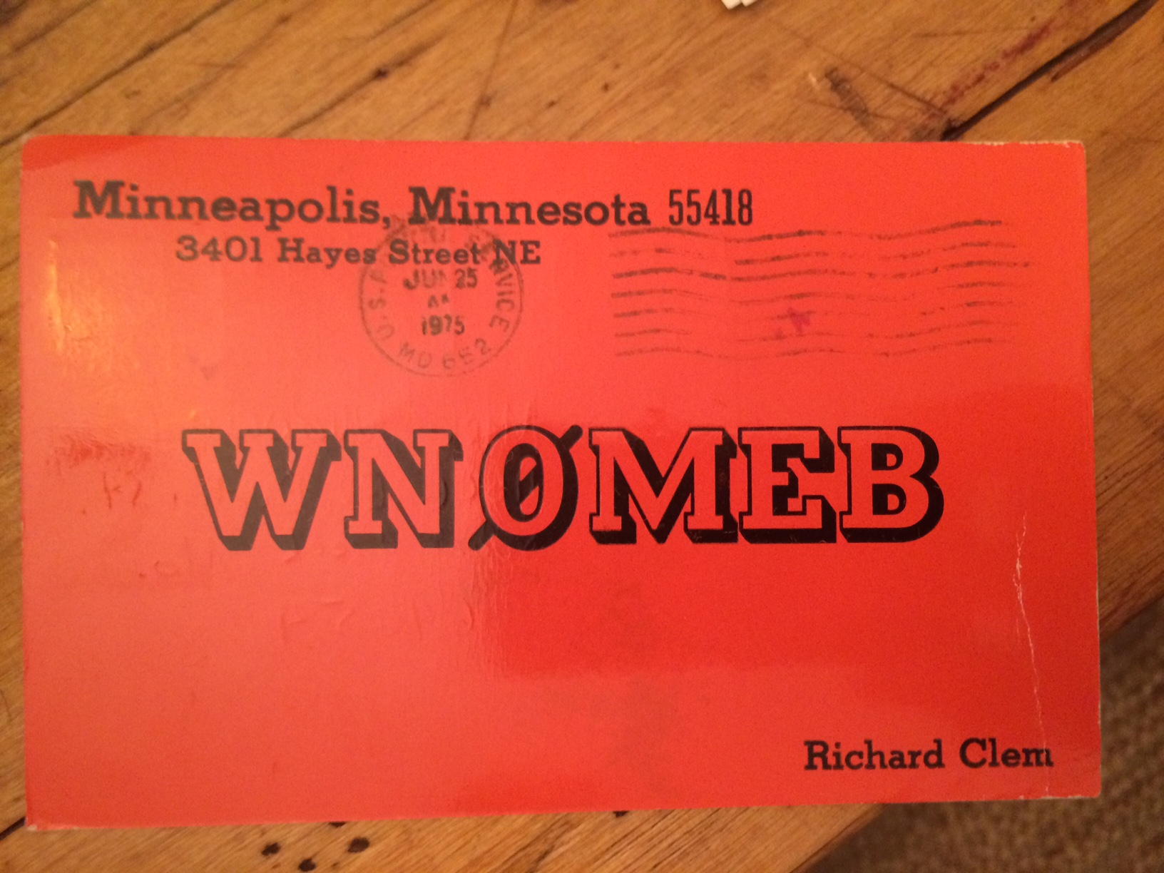
1975 QSL Card

IMG_2047

IMG_2048

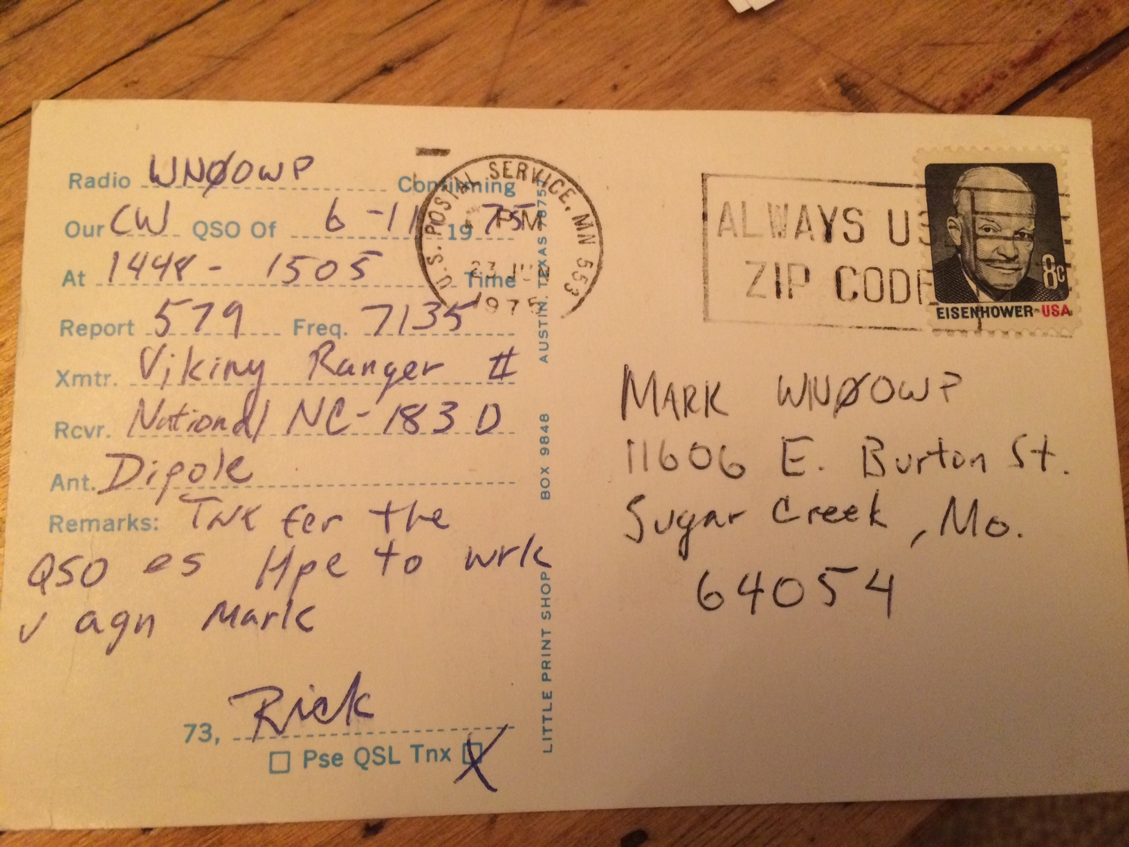
I got a nice surprise in the form of an e-mail from Mark, AE6RT, formerly WN0OWP. He had googled his old call sign, and came across my Old QSL page, where I have listed the QSL cards I have from my first days as a ham in the 1970’s.

He included the photos of my card, which I sent to him in 1975 after a 40 meter CW QSO.  Of course, I still had his card and sent him a scan of it as well.

Click Here For Today’s Ripley’s Believe It Or Not Cartoon


A Montana National Parks On The Air Activation

Big Hole Battlefield, Wyoming. NPS photo.

Big Hole Battlefield, Wyoming. NPS photo.

Tim, AE7PJ posted an interesting video showing his experience as an activator in the ARRL National Parks On The Air (NPOTA) event. He was operating from near Wisdom, Montana, at a point where three National Park Service units converge: The Big Hole Battlefield, the Nez Perce Historic Park, and the Lewis and Clark Trail.

The Lewis and Clark Trail traces the route of the 1804-06 Corps of Discovery from Illinois to Washington.  This particular spot was along the route of Clark’s return journey, following the Yellowstone River and then along the route of modern day Interstate 94. The Big Hole National Battlefield is the site of the August 9, 1877, Battle of Big Hole between the U.S. Army and the Nez Perce encamped there.  The National Battlefield is one of six units in four states of the Nez Perce National Historic Park, devoted to the history and culture of the Nez Perce (Nimiipuu) people and the 1877 conflict.

Tim condensed his two-hour operation into a nine-minute video, and it sounds like he listed all of the call signs he worked and has a brief snippet of everyone’s audio.  You can see my call, W0IS, scroll by at 5:46, and you’ll hear me saying “59 Minnesota” at 6:08.

Tim was running a Hamstick vertical antenna on his vehicle, the same antenna that I’ve used for my activations so far.  It has the advantage of being inexpensive and convenient to carry around.  It’s not particularly efficient, but as you can see from the video, it gets the job done.  He was running about 100 watts.  My activations have used a Yaesu FT-817, running only 5 watts.  While the 5 watts is adequate for CW contacts, the added power really makes a difference in being able to make voice contacts.

The video references the NPOTA Facebook group, which has become a very active forum for discussing NPOTA, and also providing spots to help other chasers find the stations in the parks, some of which can be quite weak.  In Tim’s case, he had posted his plans, and a number of us kept tuning the band looking for his signal.  I think I was the first one to spot him, but he was too weak to work when he first came on.  While waiting for him to show up, I did have the pleasure of working WC8VOA, the ham station located at the former Voice of America relay station in Bethany, Ohio.  For many decades, that station broadcast worldwide, as documented in the video below.   Two historic sites in one night–not a bad use of radio.

Click Here For Today’s Ripley’s Believe It Or Not Cartoon


National Parks On The Air “Park To Park” QSO

Photo of bridge at Chickasaw National Recreation Area

Chickasaw National Recreation Area, Oklahoma. NPS photo.

I had my first “park to park” QSO today in the ARRL National Parks On The Air (NPOTA) event.  On the way to do some grocery shopping, I decided to make a quick stop near the Mississippi River, at a parking lot just south of Summit Avenue on the St. Paul side of the river.  It’s at a fairly good elevation above the water, but it’s within the required 100 feet of the river.

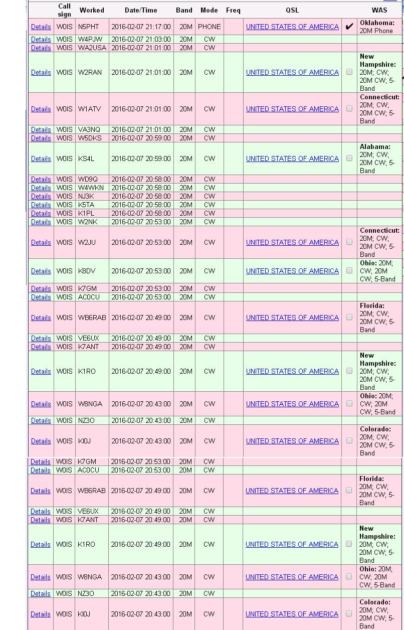
I worked about 35 contacts on 20 meter CW in about a half hour, as shown in the log below.  When the pileup subsided, I decided to try phone.  In a previous “activation” from this location, I had managed to work about 50 contacts, but that was after I was “spotted” on the DX cluster.  Without that help, my 5 watt signal didn’t attract anyone’s attention on the crowded band, and I called CQ for about 10 minutes without any takers.  Before packing up, I decided to tune the band and look for any other strong signals.

After a few minutes, I heard Gary, N5PHT, who I had already worked a few times from home.  He was operating from a campground at the  Chickasaw National Recreation Area in Oklahoma.  He had a booming signal and easily pulled my weak signal out of the noise.

Gary’s station is described on his website.  The difference in signal is attributable to the fact that he is running 100 watts to a better antenna, with a nice station set up in his motorhome.  Even though he was portable, he had a formidable signal, and has worked about 2000 contacts in about a week from this portable location.


npota020716


Ice Age National Scientific Reserve: ARRL National Parks On The Air

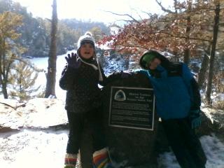
The Ice Age Trail Marker at Interstate State Park.

The Ice Age Trail Marker at Interstate State Park.

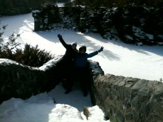
Today, my kids (shown in the photos) and I did a little bit more exploration of a nearby unit of the National Park Service, for the ARRL National Parks On The Air (NPOTA) event.  There aren’t many actual National Parks within driving distance of the Twin Cities, but there are a number of units that are part of, or affiliated with, the National Park Service.

Another “National Park” Close to Home

I was suprised to learn that one of them was Interstate State Park in Wisconsin, which is one of nine Wisconsin parks included in something called the Ice Age National Scientific Reserve,  an affiliated unit of the National Park Service (NPS).  Therefore, an activation from this park “counts” for NPOTA, and today, I went to check out the possibilities.  The kids had the day off from school and it gave them a chance to get outside.

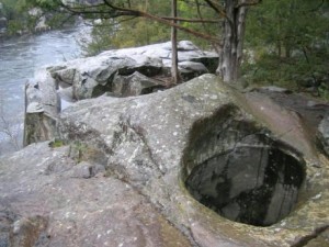
Pothole

Glacial Pothole at Interstate State Park. National Park Service photo.

The “Ice Age” nomenclature for Interstate State Park is very fitting, because the landscape was carved out by the glaciers.  The portion of the trail we were on today is called Pothole Trail, since it is the site of massive potholes carved into the rock by the combined action of glaciers and the rushing water as they receded.  Over the eons, boulders got captured by whirlpools, where they ground deep potholes into the solid rock.  Because of the snow cover, we didn’t see any today, but there are many examples just across the river in the eponymous Interstate State Park in Minnesota.

Good News for Parents of Fourth Graders

But more importantly, I had a selfish motive for bringing the kids along.  One of my kids is in fourth grade.  Under the National Parks Service Every Kid in a Park program, every fourth grader in the nation is entitled to a free pass to all national parks and other federal sites until August 31.  They can bring with them an unlimited number of children, and up to three adults.  Since Interstate Park has a connection with the National Parks Service, this means that I get in free, as long as I bring my daughter.

This represents a huge savings in money.  The National Parks Service normally charges about $80 for an equivalent pass.  And an annual non-resident vehicle sticker for the Wisconsin State Parks is normally $38.  So the fortuitous circumstance of having a fourth grader in the household will represent a big savings.  We buy a Minnesota State Park sticker every year, but don’t usually buy the $38 sticker for the Badger State.  Therefore, free admission to this Wisconsin State Park is a nice added bonus for the NPS permit.

Confirming a NPOTA “3’fer”

The reason why I wanted to scout out the park is because it offers a unique opportunity to activate three NPS units.  I’ve already operated from the St. Croix Wild and Scenic River, which serves as the park’s boundary.  Therefore, any operation from the park within a hundred feet of the water will count as two units.  But the park also serves as the Western terminus of the Ice Age National Scenic Trail.  Today, I had to confirm that there was a location that would qualify for all three.

The National Scenic Reserve activation requires operation anywhere within the park’s boundaries.  And the River requires operation from within 100 feet of the river.  Operation from the Scenic Trail requires two things.  First, the actual operating location must be within 50 yards of the trail, and must be reached using human power.  In other words, it is not permissible to operate from a vehicle.  Therefore, I had to confirm that there was a location within 50 yards of the trail that is also within 100 yards of the water.  And the photos shown here confirm that there is indeed such a spot.

IceAgeSciReserve

The viewing point just below the trail marker. The frozen river is directly below, as seen in the background.

The first photo at the top of this page is a marker indicating the Western Terminus of the scenic trail.  There’s a parking lot less than a quarter of a mile from this spot, and it’s an easy hike in.  The exact location of this boulder might be slightly more than 100 feet from the water, but the second photo shows an observation area, less than 50 yards from the trail marker, that is directly above the water.  There’s plenty of room for setting up a radio and a small antenna, and I’ll certainly be operating from this spot later this year.

I did talk to the Rangers to make sure they were aware of the NPOTA event.  One of them had already spoken to a local ham who planned to operate from the park some weekend.  They confirmed that there were no problems with operating from the park, as long as hams don’t get in the way of other visitors.  I reassured him that “Leave No Trace” principles were an important part of the NPOTA event.

I only had time to do a bit of operating.  While the kids were sledding in the park (no, not near a cliff over the river), I set up my mobile antenna and called CQ.  Unfortunately, this was at an elevation near the river, and it was a very poor location for RF.  Nonetheless, I did work three stations, one in Texas on 20 meters, and two in Colorado on 30 meters.  Interestingly, one of the stations I worked was also mobile.

Taking Advantage of the Reverse Beacon Network

I suspect that if I had been spotted on the DX cluster, I would have had a big pileup of stations looking for this still relatively rare unit, despite my poor operating location.  I had announced the activation, but I suspect that few would be patient enough to wait for me, since I was unable to predict the exact time of my activation.  However, this experience did highlight one tool that could be very helpful in locating weak NPOTA activations, the Reverse Beacon Network, an amazing system in which numerous receivers are constantly skimming the digital and CW bands looking for stations calling CQ.  As soon as they are heard, they are immediately spotted.

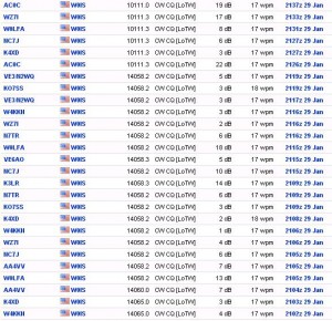
Here’s what the Reverse Beacon Network picked up from me today and made available to anyone who wanted to look for it on the Internet:

RBN

As you can see, I was 19 dB above the noise at at least one location, and copiable at many others.  In light of this experience, I encourage NPOTA chasers (and those operating similar events, such as Summits On The Air) to make use of this resource.  If you know that someone is going to be activating a park you need, but don’t know the exact time or frequency, simply search for that call at ReverseBeacon.net.  Even if you don’t plan to work the station on CW, this resource could be very helpful.  Even if you can’t copy CW, you will get the exact frequency, and you’ll be able to hear them.  When they stop, there’s a good chance that they are moving to phone.  You’ll know how strong a station you’re looking for, and you can tune the phone band looking for them.

As an experiment, I did make a CW CQ on the phone frequency where I was frantically calling CQ.  I was hoping that the Reverse Beacon Network would pick up this call as well.  But as I suspected, it did not.  It appears that the skimmers of the Reverse Beacon Network are scouring only the CW portion of the band.  Therefore, the network can’t be used to self-spot in this manner.

However, even if an activator is planning on working mostly phone, it would be a good practice to work CW or digital first, before QSY’ing to phone.  Even if you don’t make any contacts on CW, it will let others know that you are on the air, and they will know to look for you on phone if you plan to operate there as well.

When conditions for outdoor operation get better, I encourage other activators to take advantage of the “3fer” status of this particular park.  The spot I located was on the “Pothole Trail,” which can be found on the park map.  For mobile activation of only the park, the best location is probably the parking lot of the Ice Age Interpretive Center, which appears to have the highest elevation of any of the parking lots in the park.  It also contains a number of interesting exhibits regarding the nature and geology of the park.  And it’s absolutely free, as long as you have a fourth grader willing to accompany you!


National Parks On The Air: Saint Croix Boom Site

StCroixJan23A

Installing the antenna.

I rarely get a chance to experience a “pileup” on the radio, but today I was able to.  As I recounted in an earlier post, the ARRL is sponsoring an event called National Parks on The Air in which hams are encouraged to operate from units of the National Park Service and to make contact with those stations.  In addition to the 59 National Parks, this includes other units of the National Park Service.  Two of these are located within a few miles of my house, the Saint Croix National Scenic Riverway and the the Mississippi National River and Recreation Area.  Under the ARRL rules, as long as the station is within 100 feet of one of these rivers, it qualifies.

My assistant operator.

My assistant operator.

A close examination of Google Maps revealed that most of the parking lot of the Saint Croix Boom Site near Stillwater is within 100 feet of the river.  In addition, it’s at a high location above the river, which is better suited for radio transmissions.  And until today, nobody had activated this unit.  So this afternoon, along with my daughter, I set out for this location.  As with my previous activation, my station consisted of my Yaesu FT-817into a Hamstick mobile antenna mounted with a trunk mount.  The antenna, about six feet long, is shown in the photo at the top of this page.

Today, I operated for only about a half hour, but was almost immediately confronted with a pileup.  In just over thirty minutes, I worked 36 contacts:

StCroixLOTW
Since I was on 20 meters, I had few, if any, contacts within a few hundred miles.  On that band, those close-in contacts are within the “skip zone,” meaning that the signals are reflected by the ionosphere only much further distances.  I believe my closest contact was Colorado, but I had contacts with locations such as California, Alberta, and New Hampshire.  The amazing thing is that I was using only five watts of power.  I was getting the power from the car (which I kept running for heat), but I could have just as easily made all of those contacts with the radio’s internal 8 AA batteries.  And my antenna, only about five feet long, is grossly inefficient.  In addition, as you can see from the photo, it was partially blocked by the car itself.  But it goes to show that if hams really want to make the contact, they’ll listen for the weak ones.

Google Street View of my operating location.

Google Street View of my operating location.

Living in the city, it’s easy to forget how close some of the natural wonders of the area really are.  and Saint Croix National Scenic Riverway includes a lot of gems.  In addition to the National Park facilities, at least four Minnesota State Parks border the river:  William O’Brien Interstate, Wild River, and St. Croix.  I’ve already identified several sites in their campgrounds that are within a hundred feet of the water, and I will almost certainly make more activations later in the year from one of these spots.

The site from which I was operating today is the Saint Croix Boom Site, which is just north of Stillwater on Highway 95.  In fact, downtown Stillwater is visible as you look down the river.  But as you look upstream and at the Wisconsin side, it’s clear that you’re at the beginning of the wilderness.

The historic marker at this site commemorates the St. Croix Boom Company, which was chartered by the Minnesota Legislature in 1851.  The St. Croix River Valley was a major logging area, and the loggers floated the logs down the river to mills.  Each logging company’s harvest was marked with a timber mark, and the St. Croix Boom Company was granted its charter to collect all logs and deliver them to their owners.  At the location where I operated today, the company operated a series of “booms”–logs chained across the river, to catch the lumber as it floated downstream.  Workers gathered logs and formed logs of each company into rafts, which were steered downstream to the correct mill, some as far south as St. Louis.  In exchange, the company was granted the right to charge 40 cents per thousand board feet.  The photo below shows the Boom Site in operation in about 1886.

Minnesota Historical Society photo, via Wikipedia.

Today, the site consists of three stops on Highway 95.  In addition to the historical marker from which I operated today, there is a stairway leading down to the river, a modern rest area just to the north, and a public access boat launch just to the south.  The site also marks the transition between the federal and state zones of the river.  Upstream to the north, the river is under the jurisdiction of the National Park Service.  Downstream to the south, the river is still designated as the  Saint Croix National Scenic Riverway, but is under the jurisdiction of the Minnesota and Wisconsin Departments of Natural Resources.