After two and a half months, the ARRL’s National Parks On The Air (NPOTA) event has been a great success. As I’ve reported in earlier posts, the object is for amateur radio operators to operate from units of the National Park Service (NPS), and for hams at home to contact as many of those stations as possible. As of February 28, there have been a total of 136,539 confirmed contacts from 243 NPS units, with a total of 606 separate “activations.” As the spring and summer months approach, this number is sure to increase considerably. Many notable parks have not yet been activated. For example, Glacier National Park in Montana and Theodore Roosevelt National Park in North Dakota have not yet been on the air, but surely will with warmer weather.
Some sites, such as Isle Royale National Park, are currently inaccessible, and I know that activations are planned later in the year.
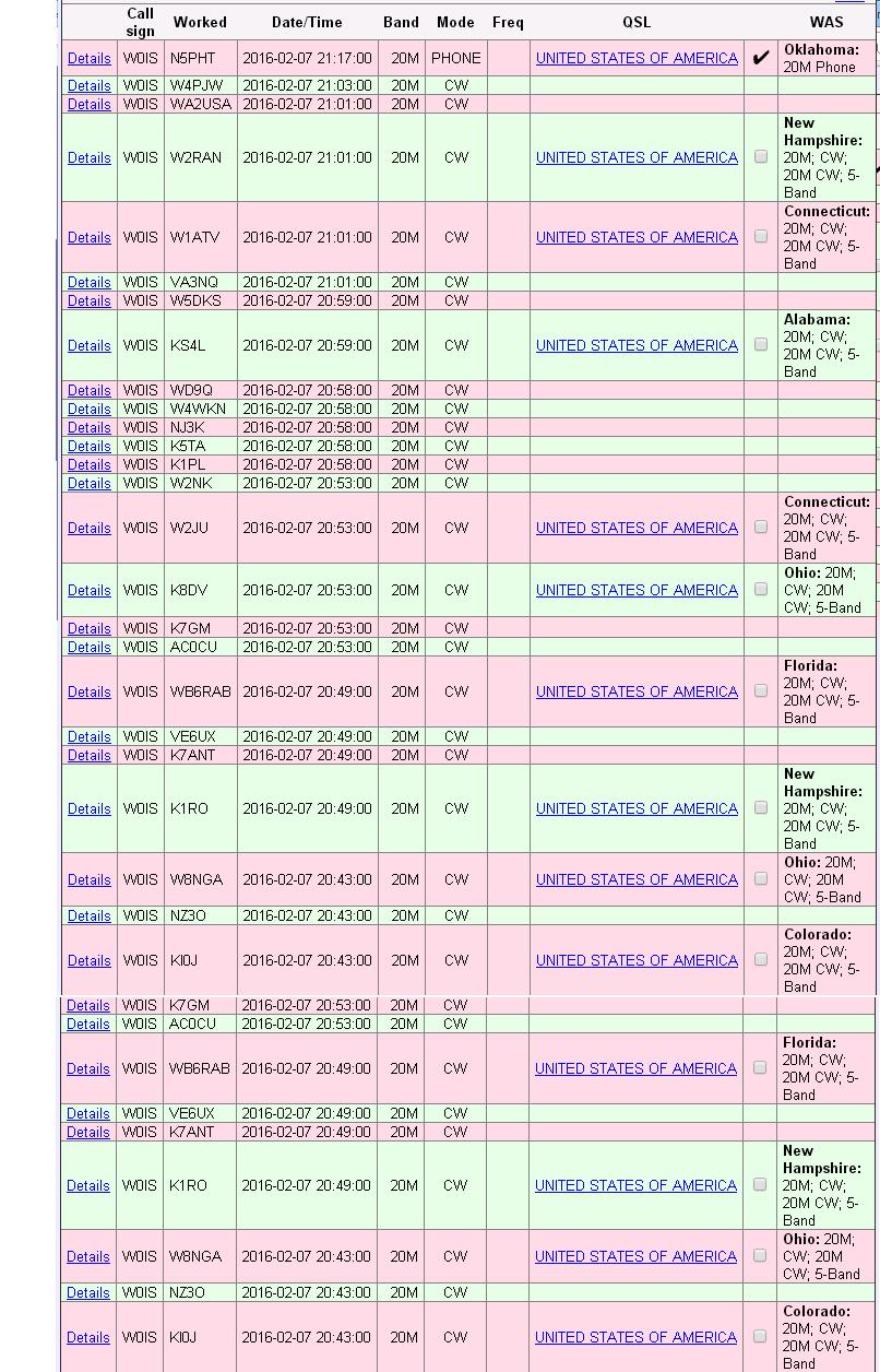
So far, even though I have yet to set foot inside an actual national park, I have made sixteen activations. This is because I live very close to two NPS units, the Mississippi National River and Recreation Area, and the St. Croix National Scenic Riverway. Because the NPOTA rules permit operation from within 100 feet of these rivers, I have been able to go to one of them with a portable transmitter and antenna on my car and activate them on short notice, such as over a lunch break. Others have made more contacts than I have, but I’ve made approximately 300. These included contacts as far away as Morocco and Cape Verde Island, and have been on the 40, 30, 20, 6, and 2 meter ham bands.
In addition, I’ve made contact with 125 different parks. These stats place me in 30th place nationwide out of 484 “activators,” and 208th place worldwide out of 6035 “chasers.”
In short, I’m not at the very top tier, and there are other experts more qualified than I am, but I do have enough experience to give some advice to both chasers and activators.
Tips For Chasers
Many of the activations result in huge pileups, and they can be somewhat daunting to a ham unaccustomed to them. However, even a very modest station is capable of working most of the parks on the air. You do not need to have a superstation! Most of the chasers have stations similar to mine, running about 100 watts to a wire antenna. Even stations with amps and large antennas don’t need them, and I’m guessing that the amp rarely gets turned on, even by those near the top of the leader board. If you have a kilowatt and a beam, great. But whether or not you do, it’s more important to rely on your skill.
The easiest way to beat a pileup is to avoid it entirely. If you get there before the pileup starts, you’ll get through with no problem at all. You’ll probably even have time to chat with the operator and learn about the park, rather than simply giving your signal report and state because others are waiting in line. And the way to avoid the pileup is to use your VFO knob and tune around the band listening for weak stations. Tune slowly, listen for weak signals, and see if they are saying “CQ National Parks On The Air.” Another sure fire way to spot a park is to listen for slightly stronger stations saying something like, “thanks for activating.” When you hear that, you know that there’s an activator on that frequency. And if they haven’t yet been spotted on the DX cluster, they will hear you. Remember, you don’t have a superstation, but your station is probably better than theirs. They are probably operating with low power, with a hastily set up antenna, and probably from a less than optimal radio location. If you can hear them, it’s almost guaranteed that they will be able to hear you very well, as long as you get there before the hundreds of other stations who will want to call them.
You can put yourself in this position by turning off the computer and tuning the radio dial. You’re more likely to find national park stations during the daylight hours. (I predict this will change in the summer, as NPS campgrounds fill up with hams working the lower bands throughout the night.) There are somewhat more on weekends, but there are many on the air weekdays. If you simply tune the bands (20 and 40 are the most commonly used), you will make many contacts without having to worry about pileups.
If you are near your computer, when you work the station, ask the station whether they would like you to “spot” them on a site such as DXsummit.fi or on the NPOTA Facebook group. The operator will probably say yes, since that will almost guarantee that he or she will then get the required ten contacts.
I can’t stress the importance of tuning the bands. On numerous activations, I have been calling CQ NPOTA with absolutely no takers. It can seem as if the band is totally dead or that my radio is broken. Then, I’ll finally work one station. After about two minutes, my radio invariably explodes with dozens of stations calling me. I’m not any louder than I was before. But I later discover that the first station spotted me about a minute before the pileup started.
There will be times when you can’t avoid the pileup. Once an activator has been spotted, there will be a pileup, and if you want to work them, you’ll need to jump into the fray. If you keep calling and calling, and they keep coming back to other stations, it can seem like those other stations must have more power or a better antenna. But that’s rarely the case. The best way to break a pileup is not with power or big antennas, but with operator skill.
The first step is to listen. First of all, please follow any instructions given by the operator. If the operator is going “by the numbers,” and asking for 4’s to call, then please don’t call unless you have a 4 in your callsign. They won’t work you, and when it really is your turn, you might be ignored.
You also want to listen to figure out the best way to call. In particular, see how long it typically takes between the operator saying “QRZ” and when he or she takes the first call. If it’s a modest pileup, it might be just a second. If it’s a huge pileup, it might be several seconds. This is because everyone starts calling right at first. It’s usually totally indecipherable at that point, and the operator on the other end can’t make out any calls until things settle down a bit. The secret of getting through is giving your call right at the moment when things die down. So listen to a few exchanges, and see how long it takes. If the activator usually takes about 10 seconds to come back to someone, then wait about 9 seconds, and slowly give your call, one time, phonetically. Your call is the one that will get heard.
If the operator is coming back immediately, this means that the pileup has subsided, and you’re probably best giving your call quickly, one time, phonetically. It’s almost always best to give your full call, rather than just part of it.
Either way, after you have sent your call, listen carefully. If the activator comes back to you, then come right back with your report and state, and maybe a quick pleasantry.
I don’t have a kilowatt, and I don’t have a beam. With 100 watts and a dipole, I’m almost able to get through any pileup by using these tips. In fact, I’ve had a number of “park-to-park” contacts where I was running only 5 watts to a mobile antenna. I almost always had to get through a pileup to make these contacts. But with careful timing, it’s usually possible.
If you are looking for a particular chaser who you think will be using CW or PSK31, then it’s a good idea to check their call sign on the Reverse Beacon Network or PSK Reporter websites. As soon as they start calling CQ, the skimmers will pick them up, and you’ll be directed to their exact frequency. Chances are, you’ll get there long before the pileup.
And speaking of CW and digital modes, you will add to your totals by using one of these modes in addition to SSB. Many of my activations have been CW only. Most are phone only, but by using CW or digital, you have an edge over the other chasers who are using phone only.
Tips For Activators

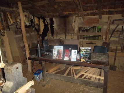
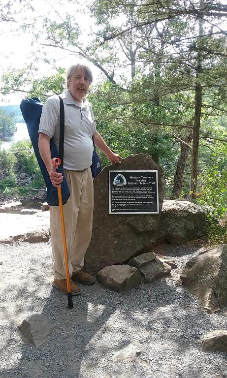
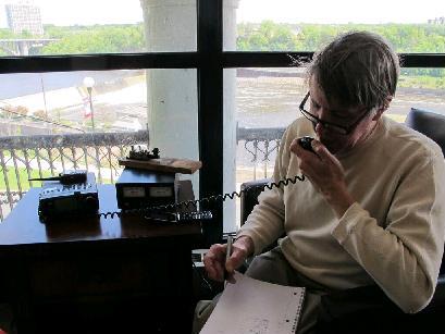
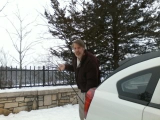
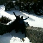
Setting up my superstation at WR09.
So far, all of my activations have been with 5 watts, running my Yaesu FT-817 to a Hamstick antenna mounted on the back of my car. When the weather gets nicer, I’ll get out of the car and put up a bigger antenna. But you can be quite successful as an activator with a very modest station.
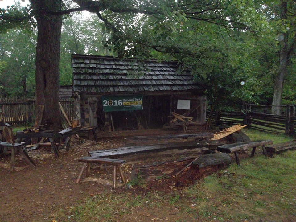
Your first step is to find a suitable location. Since the Mississippi and St. Croix Rivers span many miles, this hasn’t been difficult for me, and I’ve been able to scout out some good radio locations on bluffs overlooking the rivers. On the other hand, I’ve done some operating down near the water level, so even a site that is not optimal for radio will get out.
Whether or not to ask permission is something that you will need to consider on a case-by-case basis. If you’re operating from your car with no external antennas, then it’s probably not necessary if you’re in a legal parking spot. If you’re at a picnic table with a battery and free-standing antenna, then it’s still probably not necessary. If you’re going to install a crank-up tower right next to Old Faithful, then it probably is necessary. It’s best to use your common sense in deciding whether you need to ask.
For most of my activations so far, I’ve not asked for any kind of permission. These were mobile operations from parking lots of city parks and a state rest area. Since I’m using the location (a parking lot) for its customary purpose (parking), I don’t believe there’s any need to ask permission. More importantly, there’s nobody to ask permission. I’m simply parking in a legal parking spot and sitting in my car. Occasionally, the police have driven through, but paid no attention to me.
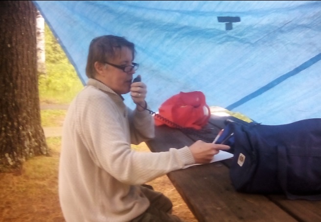
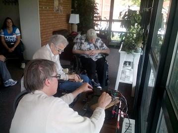
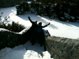
My assistants scouting out a location at AA11.
For an operation in a State Park, I did speak to the rangers beforehand, but that was mostly to let them know that I would be operating later in the year with portable antennas. While I was talking to them, I let them know that I would be operating from the parking lot that day, and they had no objections. The key is to be polite and professional.
To make it a successful activation, you need to make ten contacts. These contacts need to be entered on LOTW, but they do not need to be confirmed by the other station. This part of the event is based on the honor system. And there is also no need for the stations you work to be active “chasers.” You simply need to make ten contacts on any band or mode with ten other hams. The easiest way to accomplish this is to get yourself spotted. If you have internet access at your operating location, you can self-spot yourself on a site such as DXSummit.fi. In the comments, just put “NPOTA” and the unit number.
If you don’t have internet access, but do have cell phone access, another alternative is to call a friend and have them spot you. Or if you’re in an area with active repeaters, work another ham on the repeater and ask them to spot you. The repeater contact won’t count for NPOTA purposes, but it will get you spotted and get those additional contacts.
If you’re unable to use a cell phone or internet, or simply don’t want to rely on the spotting networks, then you’ll be on your own making your ten required contacts. But remember, there is no requirement that those ten contacts be with active chasers. And there’s certainly no requirement that those contacts be in response to your CQ. So in my most recent activations, I’ve discovered that the best strategy is to not worry about the spotting networks, and just tune the dial and make ten contacts with anyone, as soon as I get set up.
On a weekday, this can be challenging, becuase you might not find ten stations calling CQ. (However, keep in mind that there are almost always other NPOTA activators in the field, and they are calling CQ. On most of my excursions, I’ve worked one or two other NPOTA stations, and these count toward my ten.) And I haven’t done it myself yet, but other hams have suggested the County Hunters Net. Whatever county you’re in (and you need to know what county you’re in), chances are, someone will be looking for it, and you will get some or all of your ten contacts that way.
On weekends, it’s almost always possible to get your ten contacts in short order, because there is almost always some kind of contest going on. In fact, there are occasional contests during the week. Before you head out, check the contest schedule to learn which contests to look for, and what exchange you need to give. Today, for example, the Virginia and Louisiana QSO parties were taking place, and there were many stations on the air in Louisiana and Virginia looking for contacts with anyone. I wound up making eleven contacts in the Russian DX contest. I checked the rules of that contest, and QSO’s with U.S. and Canadian stations counted for contest credit, so there were plenty of big gun stations eager to work me. During the ARRL International DX Contest, I even made a number of DX contacts, although they were tougher than domestic contacts.
You should try to find out the contest exchange before the constest. However, if you’re not sure, just give a signal report and your state. If the other operator needs something else, they’ll ask for it, and they’ll be happy you took the time to give them one more contact.
After you have your ten required contacts, you’ll probably want to call CQ and see if you can generate a pileup. At first, it might be a lonely proposition with few if any stations coming back to you. You can ask the first few stations to spot you, and usually they will. Once they do, you are almost guaranteed a pileup.
Being on the receiving end of a pileup can be daunting at first, but you’ll get through it. At first, you might not be able to make out anyone’s call. But eventually, you’ll hear either a full callsign or part of one, and you can come back to that station. Eventually, you’ll chip away at it, and you’ll get them all in the log.
I’m generally not a fan of going by “numbers.” For one thing, you probably have a modest station, and are subject to fading in and out. You might have great propagation to 7-Land when you’re busy working 1’s. But by the time you get to the 7’s, the propagation is gone. For this reason, it’s probably not a good idea to work by numbers on a routine basis. But if things are totally out of hand, it might be one strategy you need to employ.
Similarly, I’ve seen very few NPOTA operations where operating split would add much benefit. “Split” means that you transmit on one frequency, and the stations calling you transmit on another frequency a few kHz away. This might make things slightly easier for the chasers, since it lessens the chance of someone transmitting on top of you. But it doesn’t really make your life any easier or increase your number of contacts by an appreciable amount. If you’re activating P5 (North Korea), then running split might be a very good idea. But if you’re activating Yellowstone National Park, it’s probably not necessary.
I’m definitely not an expert, but my five watts to a hamstick and 16 successful activations (and a couple of failed ones where I didn’t make ten contacts) show that it’s possible to be an activator without a major investment in equipment or time. Later this year, I’ll do some activations that are a bit more extravagant.
Soon after your activation, you will need to upload your log to LOTW. I haven’t bothered with any kind of software for logging. I just use pen and paper, and enter it into the computer when I get home. LOTW can appear confusing at first, but once you are set up, it’s quite simple type in your QSO’s and upload the log.
Even though you might not realize it, wherever you live in the United States, there’s probably a National Park Service unit located within an hour of your home. If you get a chance, you should get out there and see what it’s like to be on the receving end of a pileup.
Click Here For Today’s Ripley’s Believe It Or Not Cartoon